
X18A Snowflake, AZ, USA - Earthquake Result Viewer
| ||||||||||||||||||
| ||||||||||||||||||
| ||||||||||||||||||
|
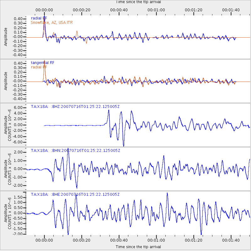
Signal To Noise
| Channel | StoN | STA | LTA |
| TA:X18A: :BHN:20070716T01:25:22.125005Z | 13.657737 | 4.798685E-7 | 3.5135287E-8 |
| TA:X18A: :BHE:20070716T01:25:22.125005Z | 10.285334 | 4.1640624E-7 | 4.048544E-8 |
| TA:X18A: :BHZ:20070716T01:25:22.125005Z | 39.940845 | 1.8302921E-6 | 4.582507E-8 |
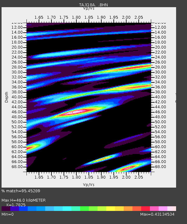
| Arrivals | |
| Ps | 5.7 SECOND |
| PpPs | 19 SECOND |
| PsPs/PpSs | 25 SECOND |

