X18A Snowflake, AZ, USA - Earthquake Result Viewer
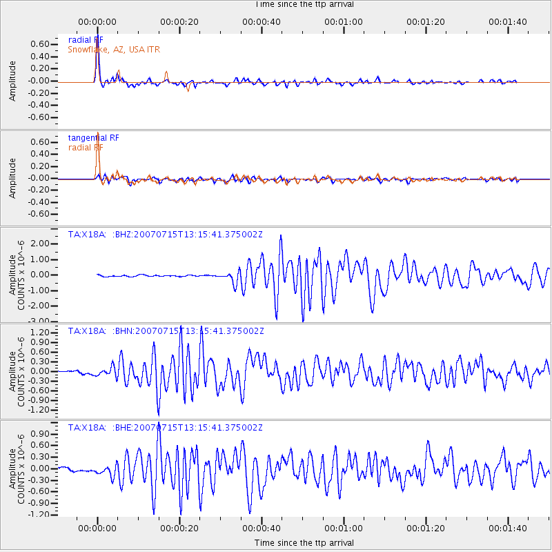
Earthquake location: Fox Islands, Aleutian Islands
Earthquake latitude/longitude: 52.5/-168.0
Earthquake time(UTC): 2007/07/15 (196) 13:08:00 GMT
Earthquake Depth: 10 km
Earthquake Magnitude: 5.8 MB, 5.9 MS, 6.1 MW, 6.0 MW
Earthquake Catalog/Contributor: WHDF/NEIC
Network: TA USArray Transportable Network (new EarthScope stations)
Station: X18A Snowflake, AZ, USA
Lat/Lon: 34.53 N/109.95 W
Elevation: 1751 m
Distance: 44.5 deg
Az: 90.007 deg
Baz: 312.199 deg
Ray Param: 0.07187913
Estimated Moho Depth: 43.5 km
Estimated Crust Vp/Vs: 1.68
Assumed Crust Vp: 6.496 km/s
Estimated Crust Vs: 3.878 km/s
Estimated Crust Poisson's Ratio: 0.22
Radial Match: 96.29394 %
Radial Bump: 235
Transverse Match: 88.76392 %
Transverse Bump: 384
SOD ConfigId: 2564
Insert Time: 2010-03-06 15:48:26.169 +0000
GWidth: 2.5
Max Bumps: 400
Tol: 0.001

Signal To Noise

ChannelStoNSTALTA
TA:X18A: :BHN:20070715T13:15:41.375002Z2.94864941.3977831E-74.740418E-8
TA:X18A: :BHE:20070715T13:15:41.375002Z3.84294681.3804662E-73.5922074E-8
TA:X18A: :BHZ:20070715T13:15:41.375002Z8.6950483.73954E-74.30077E-8
Arrivals
Ps4.9 SECOND
PpPs17 SECOND
PsPs/PpSs22 SECOND