You are here: Home > Network List > TA - USArray Transportable Network (new EarthScope stations) Stations List
> Station X18A Snowflake, AZ, USA > Earthquake Result Viewer
X18A Snowflake, AZ, USA - Earthquake Result Viewer

| Earthquake location: |
Central Mid-Atlantic Ridge |
| Earthquake latitude/longitude: |
0.7/-30.3 |
| Earthquake time(UTC): |
2007/07/03 (184) 08:26:00 GMT |
| Earthquake Depth: |
10 km |
| Earthquake Magnitude: |
5.8 MB, 5.9 MS, 6.3 MW, 6.1 MW |
| Earthquake Catalog/Contributor: |
WHDF/NEIC |
|
| Network: |
TA USArray Transportable Network (new EarthScope stations) |
| Station: |
X18A Snowflake, AZ, USA |
| Lat/Lon: |
34.53 N/109.95 W |
| Elevation: |
1751 m |
|
| Distance: |
81.1 deg |
| Az: |
304.697 deg |
| Baz: |
95.277 deg |
| Ray Param: |
0.047832437 |
| Estimated Moho Depth: |
66.75 km |
| Estimated Crust Vp/Vs: |
1.66 |
| Assumed Crust Vp: |
6.496 km/s |
| Estimated Crust Vs: |
3.907 km/s |
| Estimated Crust Poisson's Ratio: |
0.22 |
|
| Radial Match: |
80.05172 % |
| Radial Bump: |
400 |
| Transverse Match: |
60.61307 % |
| Transverse Bump: |
400 |
| SOD ConfigId: |
2564 |
| Insert Time: |
2010-03-06 15:48:32.979 +0000 |
| GWidth: |
2.5 |
| Max Bumps: |
400 |
| Tol: |
0.001 |
|
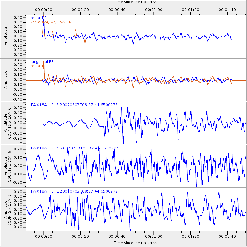
Signal To Noise
| Channel | StoN | STA | LTA |
| TA:X18A: :BHN:20070703T08:37:44.650027Z | 1.2818849 | 1.009681E-7 | 7.876534E-8 |
| TA:X18A: :BHE:20070703T08:37:44.650027Z | 2.3752732 | 1.5527877E-7 | 6.5373015E-8 |
| TA:X18A: :BHZ:20070703T08:37:44.650027Z | 2.945128 | 3.2799468E-7 | 1.1136857E-7 |
| Arrivals |
| Ps | 7.0 SECOND |
| PpPs | 27 SECOND |
| PsPs/PpSs | 34 SECOND |


