
X18A Snowflake, AZ, USA - Earthquake Result Viewer
| ||||||||||||||||||
| ||||||||||||||||||
| ||||||||||||||||||
|
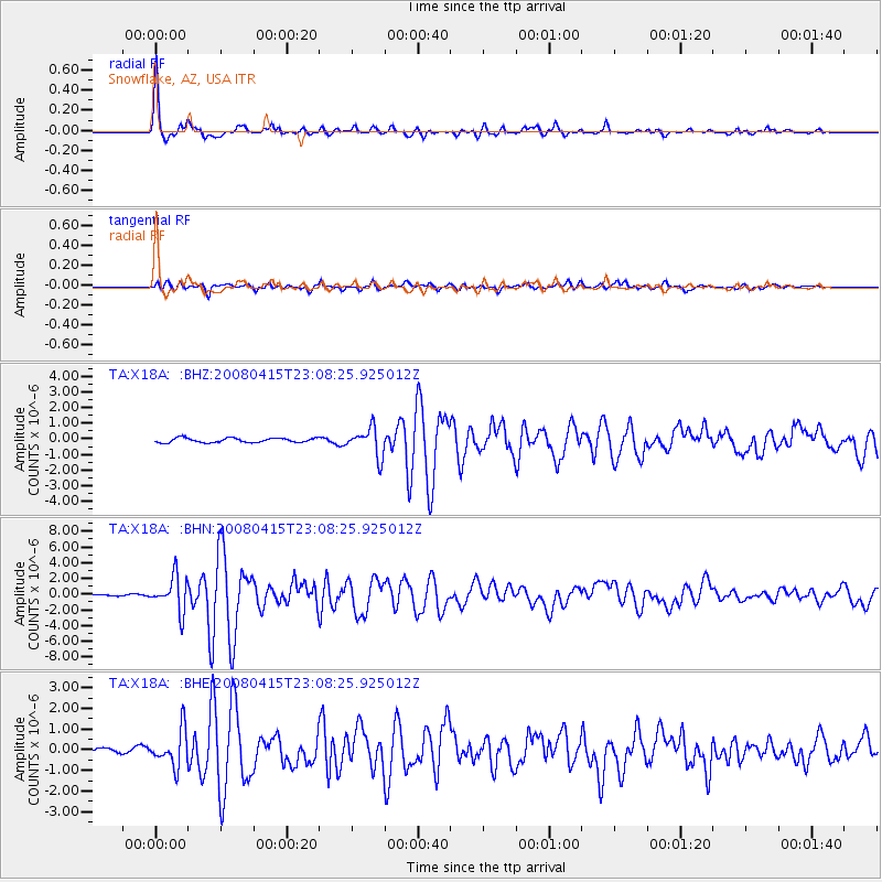
Signal To Noise
| Channel | StoN | STA | LTA |
| TA:X18A: :BHN:20080415T23:08:25.925012Z | 17.01381 | 2.175623E-6 | 1.2787395E-7 |
| TA:X18A: :BHE:20080415T23:08:25.925012Z | 7.9459944 | 8.779355E-7 | 1.1048781E-7 |
| TA:X18A: :BHZ:20080415T23:08:25.925012Z | 6.459724 | 9.102281E-7 | 1.4090821E-7 |
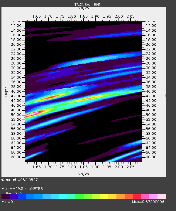
| Arrivals | |
| Ps | 5.1 SECOND |
| PpPs | 19 SECOND |
| PsPs/PpSs | 24 SECOND |

