You are here: Home > Network List > TA - USArray Transportable Network (new EarthScope stations) Stations List
> Station 121A Cookes Peak, Deming, NM, USA > Earthquake Result Viewer
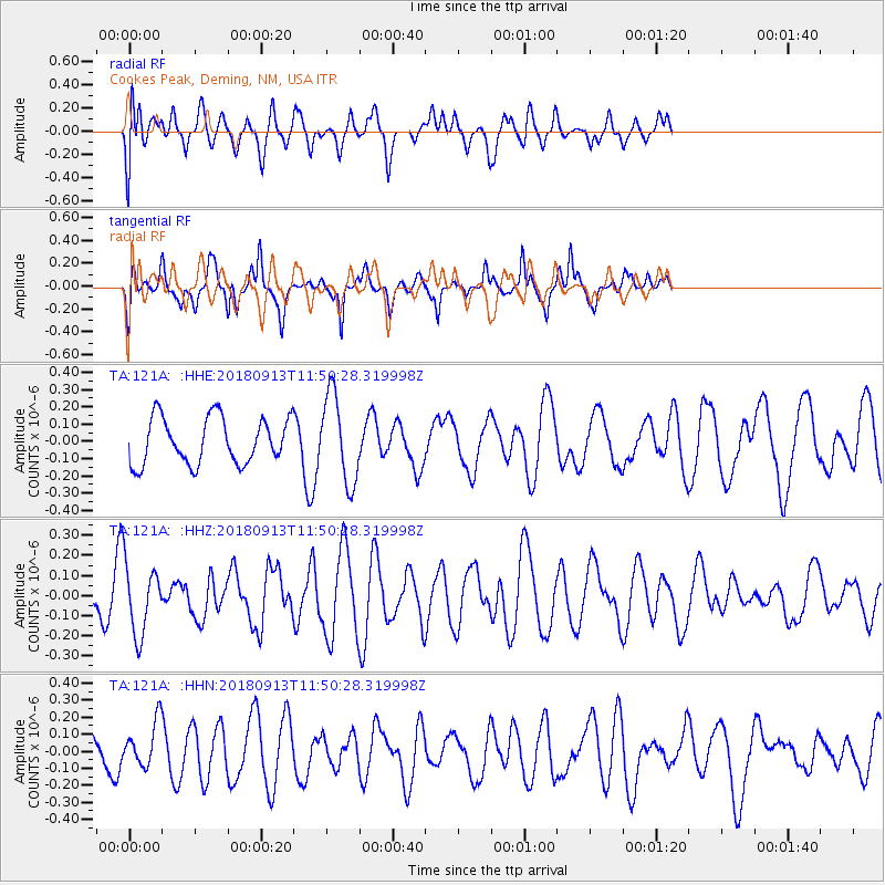
121A Cookes Peak, Deming, NM, USA - Earthquake Result Viewer
*The percent match for this event was below the threshold and hence no stack was calculated.
| Earthquake location: |
Southern East Pacific Rise |
| Earthquake latitude/longitude: |
-55.9/-123.2 |
| Earthquake time(UTC): |
2018/09/13 (256) 11:38:04 GMT |
| Earthquake Depth: |
10 km |
| Earthquake Magnitude: |
5.5 Mww |
| Earthquake Catalog/Contributor: |
NEIC PDE/us |
|
| Network: |
TA USArray Transportable Network (new EarthScope stations) |
| Station: |
121A Cookes Peak, Deming, NM, USA |
| Lat/Lon: |
32.53 N/107.79 W |
| Elevation: |
1652 m |
|
| Distance: |
89.0 deg |
| Az: |
12.987 deg |
| Baz: |
188.623 deg |
| Ray Param: |
$rayparam |
*The percent match for this event was below the threshold and hence was not used in the summary stack. |
|
| Radial Match: |
46.246677 % |
| Radial Bump: |
400 |
| Transverse Match: |
85.453384 % |
| Transverse Bump: |
400 |
| SOD ConfigId: |
13570011 |
| Insert Time: |
2019-05-01 05:41:53.762 +0000 |
| GWidth: |
2.5 |
| Max Bumps: |
400 |
| Tol: |
0.001 |
|
Signal To Noise
| Channel | StoN | STA | LTA |
| TA:121A: :HHZ:20180913T11:50:28.319998Z | 1.6312655 | 1.7230981E-7 | 1.05629525E-7 |
| TA:121A: :HHN:20180913T11:50:28.319998Z | 1.2534891 | 1.2990087E-7 | 1.0363143E-7 |
| TA:121A: :HHE:20180913T11:50:28.319998Z | 1.909388 | 2.5456345E-7 | 1.3332202E-7 |
| Arrivals |
| Ps | |
| PpPs | |
| PsPs/PpSs | |


