You are here: Home > Network List > TA - USArray Transportable Network (new EarthScope stations) Stations List
> Station X18A Snowflake, AZ, USA > Earthquake Result Viewer
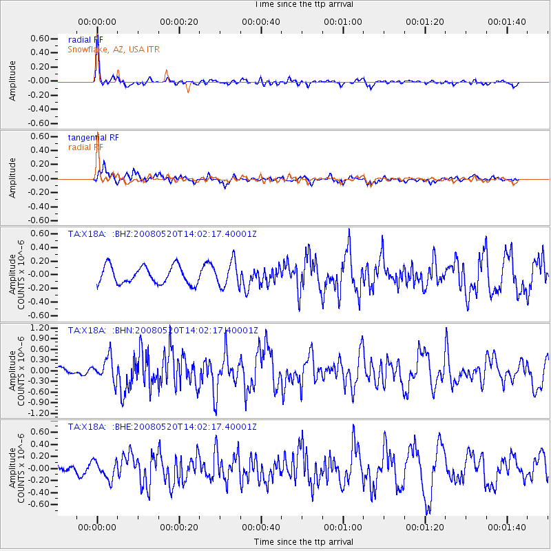
X18A Snowflake, AZ, USA - Earthquake Result Viewer
*The percent match for this event was below the threshold and hence no stack was calculated.
| Earthquake location: |
Rat Islands, Aleutian Islands |
| Earthquake latitude/longitude: |
51.2/178.8 |
| Earthquake time(UTC): |
2008/05/20 (141) 13:53:35 GMT |
| Earthquake Depth: |
27 km |
| Earthquake Magnitude: |
5.8 MB, 6.0 MS, 6.3 MW, 6.3 MW |
| Earthquake Catalog/Contributor: |
WHDF/NEIC |
|
| Network: |
TA USArray Transportable Network (new EarthScope stations) |
| Station: |
X18A Snowflake, AZ, USA |
| Lat/Lon: |
34.53 N/109.95 W |
| Elevation: |
1751 m |
|
| Distance: |
52.8 deg |
| Az: |
79.173 deg |
| Baz: |
311.487 deg |
| Ray Param: |
$rayparam |
*The percent match for this event was below the threshold and hence was not used in the summary stack. |
|
| Radial Match: |
77.038284 % |
| Radial Bump: |
400 |
| Transverse Match: |
77.41433 % |
| Transverse Bump: |
400 |
| SOD ConfigId: |
2504 |
| Insert Time: |
2010-03-06 15:49:17.509 +0000 |
| GWidth: |
2.5 |
| Max Bumps: |
400 |
| Tol: |
0.001 |
|
Signal To Noise
| Channel | StoN | STA | LTA |
| TA:X18A: :BHN:20080520T14:02:17.40001Z | 2.8038862 | 3.4156045E-7 | 1.218168E-7 |
| TA:X18A: :BHE:20080520T14:02:17.40001Z | 1.8879516 | 1.5239206E-7 | 8.07182E-8 |
| TA:X18A: :BHZ:20080520T14:02:17.40001Z | 1.4760498 | 1.8741281E-7 | 1.2696916E-7 |
| Arrivals |
| Ps | |
| PpPs | |
| PsPs/PpSs | |


