You are here: Home > Network List > CN - Canadian National Seismograph Network Stations List
> Station INK INUVIK, NT > Earthquake Result Viewer
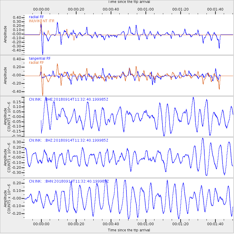
INK INUVIK, NT - Earthquake Result Viewer
*The percent match for this event was below the threshold and hence no stack was calculated.
| Earthquake location: |
Southern Peru |
| Earthquake latitude/longitude: |
-16.0/-71.5 |
| Earthquake time(UTC): |
2018/09/14 (257) 11:20:02 GMT |
| Earthquake Depth: |
121 km |
| Earthquake Magnitude: |
5.4 Mww |
| Earthquake Catalog/Contributor: |
NEIC PDE/us |
|
| Network: |
CN Canadian National Seismograph Network |
| Station: |
INK INUVIK, NT |
| Lat/Lon: |
68.31 N/133.53 W |
| Elevation: |
44 m |
|
| Distance: |
95.0 deg |
| Az: |
340.755 deg |
| Baz: |
121.522 deg |
| Ray Param: |
$rayparam |
*The percent match for this event was below the threshold and hence was not used in the summary stack. |
|
| Radial Match: |
69.91604 % |
| Radial Bump: |
400 |
| Transverse Match: |
37.685467 % |
| Transverse Bump: |
400 |
| SOD ConfigId: |
13570011 |
| Insert Time: |
2019-05-01 05:46:01.832 +0000 |
| GWidth: |
2.5 |
| Max Bumps: |
400 |
| Tol: |
0.001 |
|
Signal To Noise
| Channel | StoN | STA | LTA |
| CN:INK: :BHZ:20180914T11:32:40.199985Z | 0.44462973 | 7.857843E-8 | 1.767278E-7 |
| CN:INK: :BHN:20180914T11:32:40.199985Z | 0.8555869 | 7.0322194E-8 | 8.219176E-8 |
| CN:INK: :BHE:20180914T11:32:40.199985Z | 1.0277466 | 8.216496E-8 | 7.994671E-8 |
| Arrivals |
| Ps | |
| PpPs | |
| PsPs/PpSs | |


