You are here: Home > Network List > TA - USArray Transportable Network (new EarthScope stations) Stations List
> Station X18A Snowflake, AZ, USA > Earthquake Result Viewer
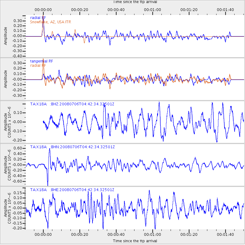
X18A Snowflake, AZ, USA - Earthquake Result Viewer
*The percent match for this event was below the threshold and hence no stack was calculated.
| Earthquake location: |
South Of Fiji Islands |
| Earthquake latitude/longitude: |
-25.5/-176.4 |
| Earthquake time(UTC): |
2008/07/06 (188) 04:30:26 GMT |
| Earthquake Depth: |
49 km |
| Earthquake Magnitude: |
5.5 MB, 5.3 MS |
| Earthquake Catalog/Contributor: |
WHDF/NEIC |
|
| Network: |
TA USArray Transportable Network (new EarthScope stations) |
| Station: |
X18A Snowflake, AZ, USA |
| Lat/Lon: |
34.53 N/109.95 W |
| Elevation: |
1751 m |
|
| Distance: |
86.7 deg |
| Az: |
49.272 deg |
| Baz: |
236.076 deg |
| Ray Param: |
$rayparam |
*The percent match for this event was below the threshold and hence was not used in the summary stack. |
|
| Radial Match: |
56.729237 % |
| Radial Bump: |
400 |
| Transverse Match: |
42.179287 % |
| Transverse Bump: |
400 |
| SOD ConfigId: |
2504 |
| Insert Time: |
2010-03-06 15:49:32.069 +0000 |
| GWidth: |
2.5 |
| Max Bumps: |
400 |
| Tol: |
0.001 |
|
Signal To Noise
| Channel | StoN | STA | LTA |
| TA:X18A: :BHN:20080706T04:42:34.32501Z | 4.855022 | 2.8287928E-7 | 5.82653E-8 |
| TA:X18A: :BHE:20080706T04:42:34.32501Z | 1.6825098 | 8.569475E-8 | 5.093269E-8 |
| TA:X18A: :BHZ:20080706T04:42:34.32501Z | 1.6881608 | 9.915084E-8 | 5.8733054E-8 |
| Arrivals |
| Ps | |
| PpPs | |
| PsPs/PpSs | |


