You are here: Home > Network List > UW - Pacific Northwest Regional Seismic Network Stations List
> Station UMAT Pilot Rock, OR, USA > Earthquake Result Viewer
UMAT Pilot Rock, OR, USA - Earthquake Result Viewer
*The percent match for this event was below the threshold and hence no stack was calculated.
| Earthquake location: |
Southern Peru |
| Earthquake latitude/longitude: |
-16.0/-71.5 |
| Earthquake time(UTC): |
2018/09/14 (257) 11:20:02 GMT |
| Earthquake Depth: |
121 km |
| Earthquake Magnitude: |
5.4 Mww |
| Earthquake Catalog/Contributor: |
NEIC PDE/us |
|
| Network: |
UW Pacific Northwest Regional Seismic Network |
| Station: |
UMAT Pilot Rock, OR, USA |
| Lat/Lon: |
45.29 N/118.96 W |
| Elevation: |
1318 m |
|
| Distance: |
74.7 deg |
| Az: |
327.365 deg |
| Baz: |
132.728 deg |
| Ray Param: |
$rayparam |
*The percent match for this event was below the threshold and hence was not used in the summary stack. |
|
| Radial Match: |
59.432472 % |
| Radial Bump: |
391 |
| Transverse Match: |
56.585888 % |
| Transverse Bump: |
400 |
| SOD ConfigId: |
13570011 |
| Insert Time: |
2019-05-01 05:51:04.945 +0000 |
| GWidth: |
2.5 |
| Max Bumps: |
400 |
| Tol: |
0.001 |
|
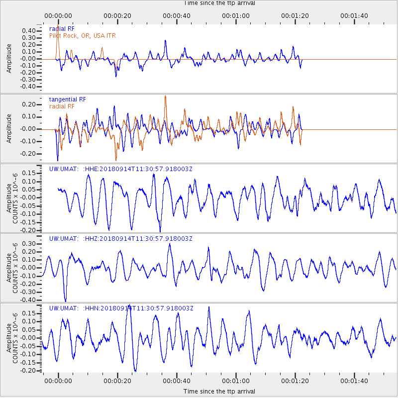
Signal To Noise
| Channel | StoN | STA | LTA |
| UW:UMAT: :HHZ:20180914T11:30:57.918003Z | 2.2121966 | 1.7259627E-7 | 7.8020314E-8 |
| UW:UMAT: :HHN:20180914T11:30:57.918003Z | 1.6836284 | 8.932575E-8 | 5.30555E-8 |
| UW:UMAT: :HHE:20180914T11:30:57.918003Z | 1.1279353 | 9.5992796E-8 | 8.510488E-8 |
| Arrivals |
| Ps | |
| PpPs | |
| PsPs/PpSs | |


