You are here: Home > Network List > TA - USArray Transportable Network (new EarthScope stations) Stations List
> Station X18A Snowflake, AZ, USA > Earthquake Result Viewer
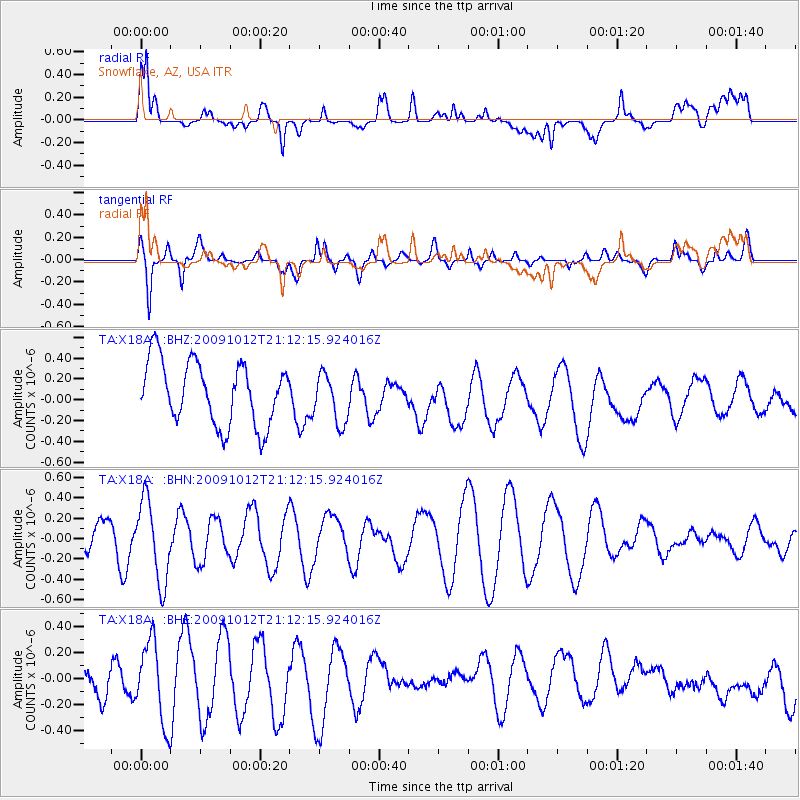
X18A Snowflake, AZ, USA - Earthquake Result Viewer
*The percent match for this event was below the threshold and hence no stack was calculated.
| Earthquake location: |
Vanuatu Islands |
| Earthquake latitude/longitude: |
-14.1/166.3 |
| Earthquake time(UTC): |
2009/10/12 (285) 20:59:38 GMT |
| Earthquake Depth: |
35 km |
| Earthquake Magnitude: |
5.7 MW, 5.4 MS, 5.2 MB, 5.7 MW |
| Earthquake Catalog/Contributor: |
WHDF/NEIC |
|
| Network: |
TA USArray Transportable Network (new EarthScope stations) |
| Station: |
X18A Snowflake, AZ, USA |
| Lat/Lon: |
34.53 N/109.95 W |
| Elevation: |
1751 m |
|
| Distance: |
92.9 deg |
| Az: |
55.265 deg |
| Baz: |
254.989 deg |
| Ray Param: |
$rayparam |
*The percent match for this event was below the threshold and hence was not used in the summary stack. |
|
| Radial Match: |
58.792057 % |
| Radial Bump: |
400 |
| Transverse Match: |
63.886204 % |
| Transverse Bump: |
400 |
| SOD ConfigId: |
2622 |
| Insert Time: |
2010-03-06 15:50:20.605 +0000 |
| GWidth: |
2.5 |
| Max Bumps: |
400 |
| Tol: |
0.001 |
|
Signal To Noise
| Channel | StoN | STA | LTA |
| TA:X18A: :BHN:20091012T21:12:15.924016Z | 3.58369 | 3.9920445E-7 | 1.11394804E-7 |
| TA:X18A: :BHE:20091012T21:12:15.924016Z | 1.9815506 | 3.1105003E-7 | 1.5697304E-7 |
| TA:X18A: :BHZ:20091012T21:12:15.924016Z | 0.7918676 | 2.3887662E-7 | 3.016623E-7 |
| Arrivals |
| Ps | |
| PpPs | |
| PsPs/PpSs | |


