You are here: Home > Network List > TA - USArray Transportable Network (new EarthScope stations) Stations List
> Station D25K Kavik River, AK, USA > Earthquake Result Viewer
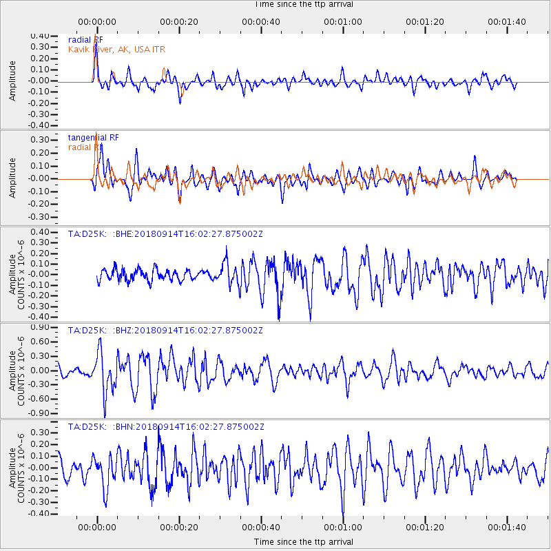
D25K Kavik River, AK, USA - Earthquake Result Viewer
*The percent match for this event was below the threshold and hence no stack was calculated.
| Earthquake location: |
Irian Jaya, Indonesia |
| Earthquake latitude/longitude: |
-2.8/138.8 |
| Earthquake time(UTC): |
2018/09/14 (257) 15:50:16 GMT |
| Earthquake Depth: |
33 km |
| Earthquake Magnitude: |
5.9 Mww |
| Earthquake Catalog/Contributor: |
NEIC PDE/us |
|
| Network: |
TA USArray Transportable Network (new EarthScope stations) |
| Station: |
D25K Kavik River, AK, USA |
| Lat/Lon: |
69.32 N/146.38 W |
| Elevation: |
770 m |
|
| Distance: |
87.3 deg |
| Az: |
20.077 deg |
| Baz: |
254.87 deg |
| Ray Param: |
$rayparam |
*The percent match for this event was below the threshold and hence was not used in the summary stack. |
|
| Radial Match: |
79.11469 % |
| Radial Bump: |
400 |
| Transverse Match: |
68.83318 % |
| Transverse Bump: |
400 |
| SOD ConfigId: |
13570011 |
| Insert Time: |
2019-05-01 05:56:39.197 +0000 |
| GWidth: |
2.5 |
| Max Bumps: |
400 |
| Tol: |
0.001 |
|
Signal To Noise
| Channel | StoN | STA | LTA |
| TA:D25K: :BHZ:20180914T16:02:27.875002Z | 5.5634913 | 4.2468378E-7 | 7.633404E-8 |
| TA:D25K: :BHN:20180914T16:02:27.875002Z | 1.35244 | 1.4125675E-7 | 1.0444586E-7 |
| TA:D25K: :BHE:20180914T16:02:27.875002Z | 2.1298103 | 1.0898671E-7 | 5.1172027E-8 |
| Arrivals |
| Ps | |
| PpPs | |
| PsPs/PpSs | |


