You are here: Home > Network List > TA - USArray Transportable Network (new EarthScope stations) Stations List
> Station X18A Snowflake, AZ, USA > Earthquake Result Viewer
X18A Snowflake, AZ, USA - Earthquake Result Viewer
*The percent match for this event was below the threshold and hence no stack was calculated.
| Earthquake location: |
Near East Coast Of Honshu, Japan |
| Earthquake latitude/longitude: |
38.8/142.4 |
| Earthquake time(UTC): |
2009/06/23 (174) 07:37:17 GMT |
| Earthquake Depth: |
37 km |
| Earthquake Magnitude: |
5.7 MB, 5.0 MS, 5.6 MW, 5.6 MW |
| Earthquake Catalog/Contributor: |
WHDF/NEIC |
|
| Network: |
TA USArray Transportable Network (new EarthScope stations) |
| Station: |
X18A Snowflake, AZ, USA |
| Lat/Lon: |
34.53 N/109.95 W |
| Elevation: |
1751 m |
|
| Distance: |
81.0 deg |
| Az: |
52.803 deg |
| Baz: |
311.116 deg |
| Ray Param: |
$rayparam |
*The percent match for this event was below the threshold and hence was not used in the summary stack. |
|
| Radial Match: |
71.57813 % |
| Radial Bump: |
400 |
| Transverse Match: |
60.235485 % |
| Transverse Bump: |
400 |
| SOD ConfigId: |
2648 |
| Insert Time: |
2010-03-06 15:50:51.848 +0000 |
| GWidth: |
2.5 |
| Max Bumps: |
400 |
| Tol: |
0.001 |
|
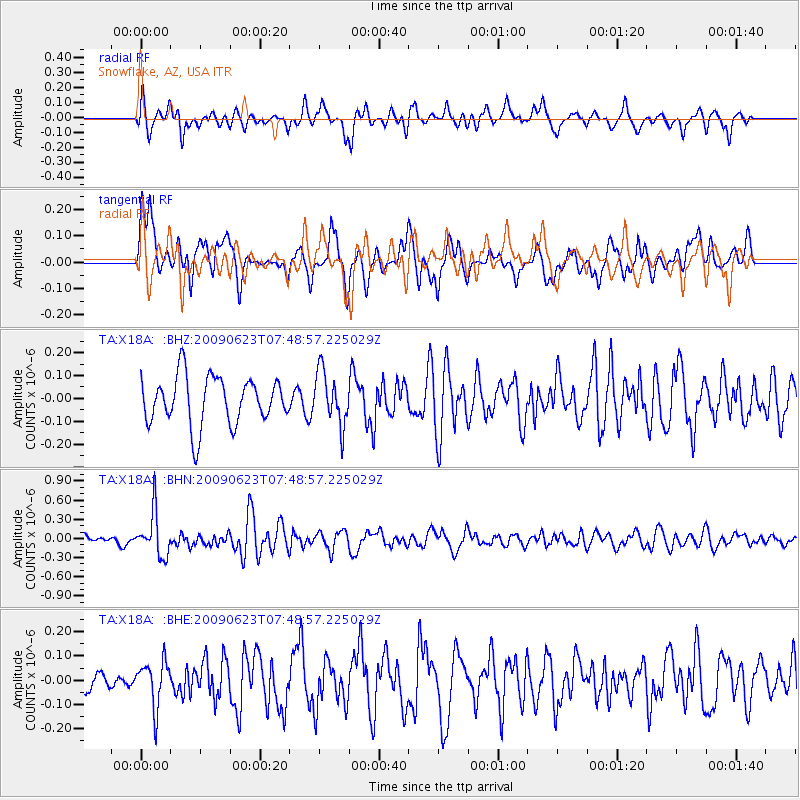
Signal To Noise
| Channel | StoN | STA | LTA |
| TA:X18A: :BHN:20090623T07:48:57.225029Z | 3.4549909 | 3.457452E-7 | 1.0007124E-7 |
| TA:X18A: :BHE:20090623T07:48:57.225029Z | 1.8843217 | 9.400123E-8 | 4.9885976E-8 |
| TA:X18A: :BHZ:20090623T07:48:57.225029Z | 1.1037309 | 1.1573713E-7 | 1.04859915E-7 |
| Arrivals |
| Ps | |
| PpPs | |
| PsPs/PpSs | |


