You are here: Home > Network List > TA - USArray Transportable Network (new EarthScope stations) Stations List
> Station G31M Satah River, YT, CAN > Earthquake Result Viewer
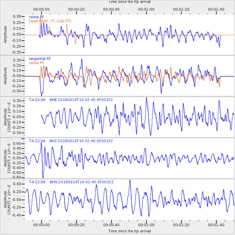
G31M Satah River, YT, CAN - Earthquake Result Viewer
*The percent match for this event was below the threshold and hence no stack was calculated.
| Earthquake location: |
Irian Jaya, Indonesia |
| Earthquake latitude/longitude: |
-2.8/138.8 |
| Earthquake time(UTC): |
2018/09/14 (257) 15:50:16 GMT |
| Earthquake Depth: |
33 km |
| Earthquake Magnitude: |
5.9 Mww |
| Earthquake Catalog/Contributor: |
NEIC PDE/us |
|
| Network: |
TA USArray Transportable Network (new EarthScope stations) |
| Station: |
G31M Satah River, YT, CAN |
| Lat/Lon: |
66.92 N/134.27 W |
| Elevation: |
61 m |
|
| Distance: |
91.3 deg |
| Az: |
23.189 deg |
| Baz: |
266.139 deg |
| Ray Param: |
$rayparam |
*The percent match for this event was below the threshold and hence was not used in the summary stack. |
|
| Radial Match: |
55.118958 % |
| Radial Bump: |
400 |
| Transverse Match: |
56.489902 % |
| Transverse Bump: |
400 |
| SOD ConfigId: |
13570011 |
| Insert Time: |
2019-05-01 05:57:11.549 +0000 |
| GWidth: |
2.5 |
| Max Bumps: |
400 |
| Tol: |
0.001 |
|
Signal To Noise
| Channel | StoN | STA | LTA |
| TA:G31M: :BHZ:20180914T16:02:46.950015Z | 3.7222493 | 3.9207714E-7 | 1.0533339E-7 |
| TA:G31M: :BHN:20180914T16:02:46.950015Z | 0.71879447 | 1.2021646E-7 | 1.6724732E-7 |
| TA:G31M: :BHE:20180914T16:02:46.950015Z | 1.4765793 | 1.4777943E-7 | 1.0008228E-7 |
| Arrivals |
| Ps | |
| PpPs | |
| PsPs/PpSs | |


