You are here: Home > Network List > TA - USArray Transportable Network (new EarthScope stations) Stations List
> Station R33M Jennings River, BC, CAN > Earthquake Result Viewer
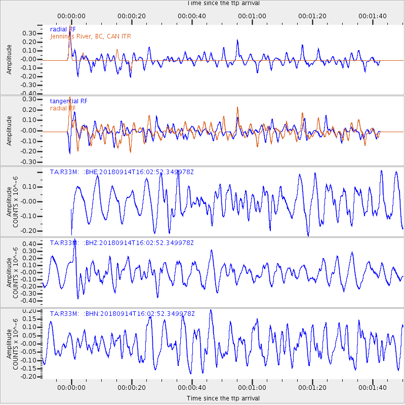
R33M Jennings River, BC, CAN - Earthquake Result Viewer
*The percent match for this event was below the threshold and hence no stack was calculated.
| Earthquake location: |
Irian Jaya, Indonesia |
| Earthquake latitude/longitude: |
-2.8/138.8 |
| Earthquake time(UTC): |
2018/09/14 (257) 15:50:16 GMT |
| Earthquake Depth: |
33 km |
| Earthquake Magnitude: |
5.9 Mww |
| Earthquake Catalog/Contributor: |
NEIC PDE/us |
|
| Network: |
TA USArray Transportable Network (new EarthScope stations) |
| Station: |
R33M Jennings River, BC, CAN |
| Lat/Lon: |
59.39 N/130.97 W |
| Elevation: |
1437 m |
|
| Distance: |
92.5 deg |
| Az: |
30.806 deg |
| Baz: |
268.835 deg |
| Ray Param: |
$rayparam |
*The percent match for this event was below the threshold and hence was not used in the summary stack. |
|
| Radial Match: |
62.61752 % |
| Radial Bump: |
400 |
| Transverse Match: |
40.94948 % |
| Transverse Bump: |
400 |
| SOD ConfigId: |
13570011 |
| Insert Time: |
2019-05-01 05:58:35.354 +0000 |
| GWidth: |
2.5 |
| Max Bumps: |
400 |
| Tol: |
0.001 |
|
Signal To Noise
| Channel | StoN | STA | LTA |
| TA:R33M: :BHZ:20180914T16:02:52.349978Z | 1.8982614 | 2.312191E-7 | 1.2180573E-7 |
| TA:R33M: :BHN:20180914T16:02:52.349978Z | 0.5759867 | 4.983653E-8 | 8.6523755E-8 |
| TA:R33M: :BHE:20180914T16:02:52.349978Z | 1.3890625 | 1.194788E-7 | 8.601398E-8 |
| Arrivals |
| Ps | |
| PpPs | |
| PsPs/PpSs | |


