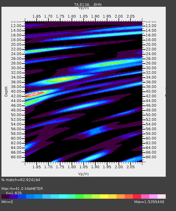
E13A Victor, MT, USA - Earthquake Result Viewer

Earthquake location: Andreanof Islands, Aleutian Is.
Earthquake latitude/longitude: 51.4/-179.5
Earthquake time(UTC): 2007/12/19 (353) 09:30:27 GMT
Earthquake Depth: 29 km
Earthquake Magnitude: 6.4 MB, 7.1 MS, 7.1 MW, 7.0 MW
Earthquake Catalog/Contributor: WHDF/NEIC
Network: TA USArray Transportable Network (new EarthScope stations)
Station: E13A Victor, MT, USA
Lat/Lon: 46.44 N/114.19 W
Elevation: 1257 m
Distance: 42.0 deg
Az: 70.054 deg
Baz: 301.544 deg
Ray Param: 0.07340778
Estimated Moho Depth: 41.0 km
Estimated Crust Vp/Vs: 1.63
Assumed Crust Vp: 6.622 km/s
Estimated Crust Vs: 4.05 km/s
Estimated Crust Poisson's Ratio: 0.20
Radial Match: 92.924164 %
Radial Bump: 400
Transverse Match: 82.02165 %
Transverse Bump: 400
SOD ConfigId: 2564
Insert Time: 2010-03-06 15:52:17.638 +0000
GWidth: 2.5
Max Bumps: 400
Tol: 0.001

Signal To Noise

ChannelStoNSTALTA
TA:E13A: :BHN:20071219T09:37:44.825002Z2.33392211.0483274E-64.4916985E-7
TA:E13A: :BHE:20071219T09:37:44.825002Z8.8538252.5165E-62.8422744E-7
TA:E13A: :BHZ:20071219T09:37:44.825002Z7.94026474.3357445E-65.460453E-7
Arrivals
Ps4.3 SECOND
PpPs15 SECOND
PsPs/PpSs19 SECOND