You are here: Home > Network List > TA - USArray Transportable Network (new EarthScope stations) Stations List
> Station G31M Satah River, YT, CAN > Earthquake Result Viewer
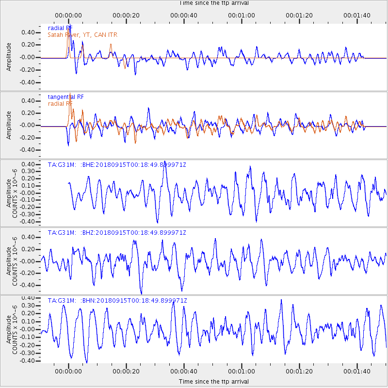
G31M Satah River, YT, CAN - Earthquake Result Viewer
*The percent match for this event was below the threshold and hence no stack was calculated.
| Earthquake location: |
Ryukyu Islands, Japan |
| Earthquake latitude/longitude: |
26.7/129.6 |
| Earthquake time(UTC): |
2018/09/15 (258) 00:08:20 GMT |
| Earthquake Depth: |
5.9 km |
| Earthquake Magnitude: |
5.6 Mww |
| Earthquake Catalog/Contributor: |
NEIC PDE/us |
|
| Network: |
TA USArray Transportable Network (new EarthScope stations) |
| Station: |
G31M Satah River, YT, CAN |
| Lat/Lon: |
66.92 N/134.27 W |
| Elevation: |
61 m |
|
| Distance: |
68.0 deg |
| Az: |
25.002 deg |
| Baz: |
286.506 deg |
| Ray Param: |
$rayparam |
*The percent match for this event was below the threshold and hence was not used in the summary stack. |
|
| Radial Match: |
69.43324 % |
| Radial Bump: |
400 |
| Transverse Match: |
40.53155 % |
| Transverse Bump: |
400 |
| SOD ConfigId: |
13570011 |
| Insert Time: |
2019-05-01 06:06:53.996 +0000 |
| GWidth: |
2.5 |
| Max Bumps: |
400 |
| Tol: |
0.001 |
|
Signal To Noise
| Channel | StoN | STA | LTA |
| TA:G31M: :BHZ:20180915T00:18:49.899971Z | 1.7799091 | 1.6078172E-7 | 9.0331426E-8 |
| TA:G31M: :BHN:20180915T00:18:49.899971Z | 1.5620406 | 2.1660635E-7 | 1.3866882E-7 |
| TA:G31M: :BHE:20180915T00:18:49.899971Z | 2.1330447 | 2.4591463E-7 | 1.1528809E-7 |
| Arrivals |
| Ps | |
| PpPs | |
| PsPs/PpSs | |


