You are here: Home > Network List > TA - USArray Transportable Network (new EarthScope stations) Stations List
> Station I23K Minto, Yukon-Koyukuk, AK, USA > Earthquake Result Viewer
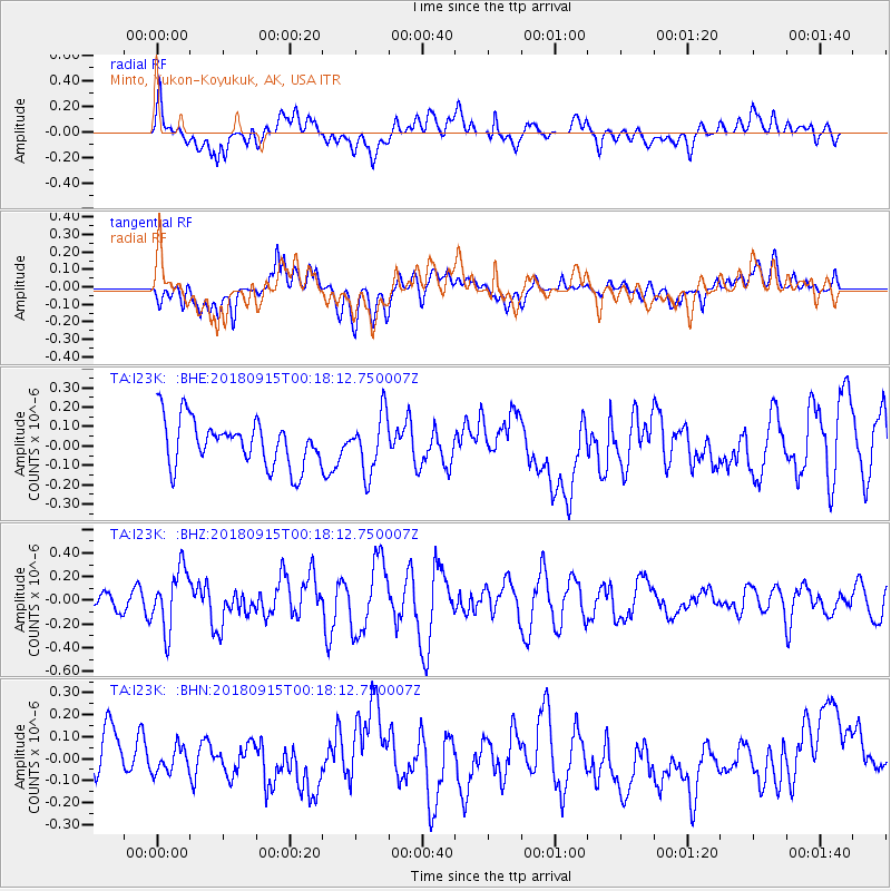
I23K Minto, Yukon-Koyukuk, AK, USA - Earthquake Result Viewer
*The percent match for this event was below the threshold and hence no stack was calculated.
| Earthquake location: |
Ryukyu Islands, Japan |
| Earthquake latitude/longitude: |
26.7/129.6 |
| Earthquake time(UTC): |
2018/09/15 (258) 00:08:20 GMT |
| Earthquake Depth: |
5.9 km |
| Earthquake Magnitude: |
5.6 Mww |
| Earthquake Catalog/Contributor: |
NEIC PDE/us |
|
| Network: |
TA USArray Transportable Network (new EarthScope stations) |
| Station: |
I23K Minto, Yukon-Koyukuk, AK, USA |
| Lat/Lon: |
65.15 N/149.36 W |
| Elevation: |
149 m |
|
| Distance: |
62.3 deg |
| Az: |
28.125 deg |
| Baz: |
274.031 deg |
| Ray Param: |
$rayparam |
*The percent match for this event was below the threshold and hence was not used in the summary stack. |
|
| Radial Match: |
59.63376 % |
| Radial Bump: |
400 |
| Transverse Match: |
54.34788 % |
| Transverse Bump: |
400 |
| SOD ConfigId: |
13570011 |
| Insert Time: |
2019-05-01 06:07:07.204 +0000 |
| GWidth: |
2.5 |
| Max Bumps: |
400 |
| Tol: |
0.001 |
|
Signal To Noise
| Channel | StoN | STA | LTA |
| TA:I23K: :BHZ:20180915T00:18:12.750007Z | 2.500768 | 2.5413115E-7 | 1.01621254E-7 |
| TA:I23K: :BHN:20180915T00:18:12.750007Z | 0.5217863 | 5.6149638E-8 | 1.0761042E-7 |
| TA:I23K: :BHE:20180915T00:18:12.750007Z | 1.2468674 | 1.4850455E-7 | 1.1910212E-7 |
| Arrivals |
| Ps | |
| PpPs | |
| PsPs/PpSs | |


