You are here: Home > Network List > CN - Canadian National Seismograph Network Stations List
> Station INK INUVIK, NT > Earthquake Result Viewer
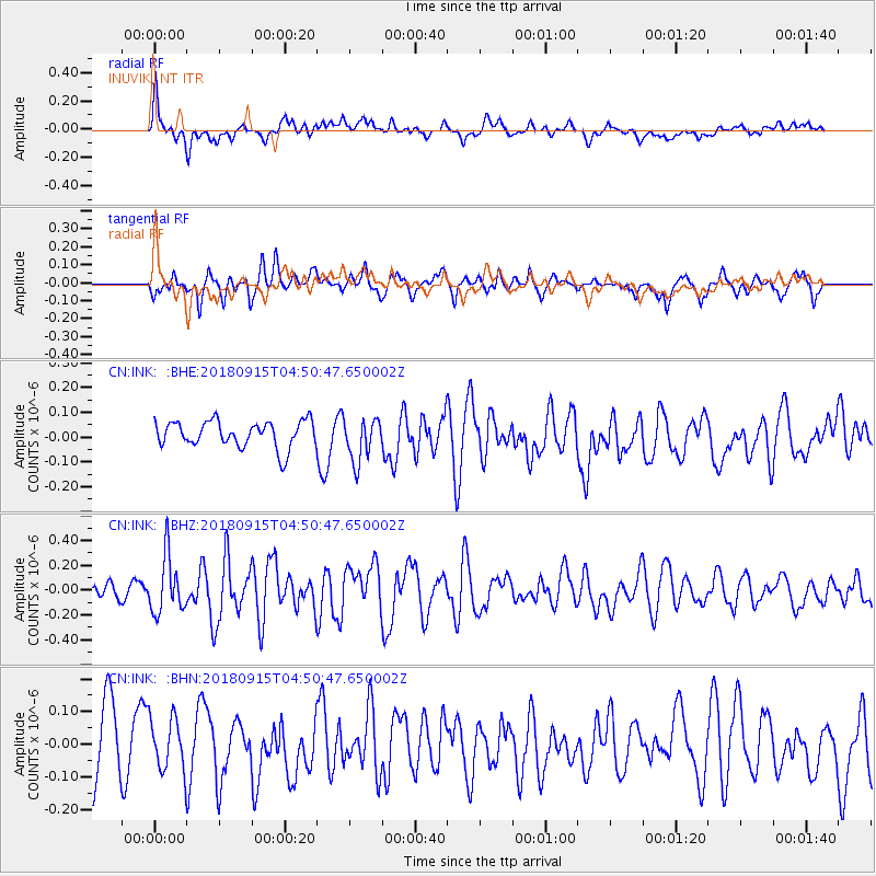
INK INUVIK, NT - Earthquake Result Viewer
*The percent match for this event was below the threshold and hence no stack was calculated.
| Earthquake location: |
Ryukyu Islands, Japan |
| Earthquake latitude/longitude: |
26.7/129.6 |
| Earthquake time(UTC): |
2018/09/15 (258) 04:40:19 GMT |
| Earthquake Depth: |
10 km |
| Earthquake Magnitude: |
5.5 Mww |
| Earthquake Catalog/Contributor: |
NEIC PDE/us |
|
| Network: |
CN Canadian National Seismograph Network |
| Station: |
INK INUVIK, NT |
| Lat/Lon: |
68.31 N/133.53 W |
| Elevation: |
44 m |
|
| Distance: |
68.0 deg |
| Az: |
23.461 deg |
| Baz: |
286.634 deg |
| Ray Param: |
$rayparam |
*The percent match for this event was below the threshold and hence was not used in the summary stack. |
|
| Radial Match: |
65.2747 % |
| Radial Bump: |
400 |
| Transverse Match: |
58.430073 % |
| Transverse Bump: |
400 |
| SOD ConfigId: |
13570011 |
| Insert Time: |
2019-05-01 06:12:14.399 +0000 |
| GWidth: |
2.5 |
| Max Bumps: |
400 |
| Tol: |
0.001 |
|
Signal To Noise
| Channel | StoN | STA | LTA |
| CN:INK: :BHZ:20180915T04:50:47.650002Z | 2.901974 | 2.271259E-7 | 7.8266E-8 |
| CN:INK: :BHN:20180915T04:50:47.650002Z | 0.84241545 | 8.190226E-8 | 9.722312E-8 |
| CN:INK: :BHE:20180915T04:50:47.650002Z | 1.6245228 | 8.685731E-8 | 5.3466355E-8 |
| Arrivals |
| Ps | |
| PpPs | |
| PsPs/PpSs | |


