E13A Victor, MT, USA - Earthquake Result Viewer
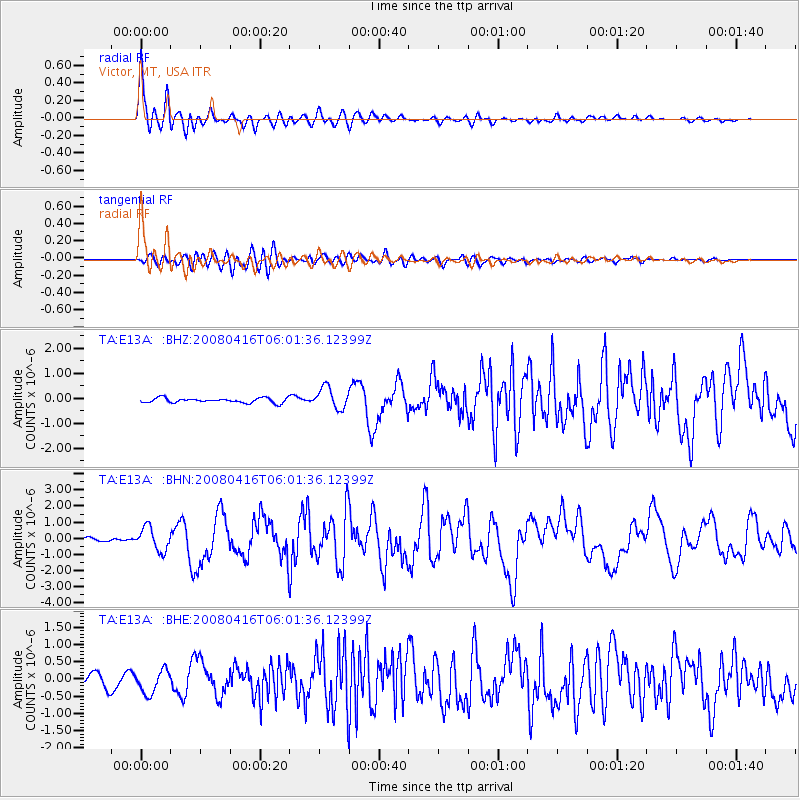
Earthquake location: Andreanof Islands, Aleutian Is.
Earthquake latitude/longitude: 51.9/-179.2
Earthquake time(UTC): 2008/04/16 (107) 05:54:19 GMT
Earthquake Depth: 13 km
Earthquake Magnitude: 6.1 MB, 6.5 MS, 6.6 MW, 6.6 MW
Earthquake Catalog/Contributor: WHDF/NEIC
Network: TA USArray Transportable Network (new EarthScope stations)
Station: E13A Victor, MT, USA
Lat/Lon: 46.44 N/114.19 W
Elevation: 1257 m
Distance: 41.6 deg
Az: 70.794 deg
Baz: 302.161 deg
Ray Param: 0.07370085
Estimated Moho Depth: 40.75 km
Estimated Crust Vp/Vs: 1.64
Assumed Crust Vp: 6.622 km/s
Estimated Crust Vs: 4.026 km/s
Estimated Crust Poisson's Ratio: 0.21
Radial Match: 94.28479 %
Radial Bump: 400
Transverse Match: 79.01742 %
Transverse Bump: 400
SOD ConfigId: 2504
Insert Time: 2010-03-06 15:54:15.936 +0000
GWidth: 2.5
Max Bumps: 400
Tol: 0.001

Signal To Noise

ChannelStoNSTALTA
TA:E13A: :BHN:20080416T06:01:36.12399Z5.97185667.1991377E-71.2055108E-7
TA:E13A: :BHE:20080416T06:01:36.12399Z2.73815563.3816926E-71.2350257E-7
TA:E13A: :BHZ:20080416T06:01:36.12399Z4.5225944.266905E-79.4346404E-8
Arrivals
Ps4.3 SECOND
PpPs15 SECOND
PsPs/PpSs19 SECOND