E13A Victor, MT, USA - Earthquake Result Viewer
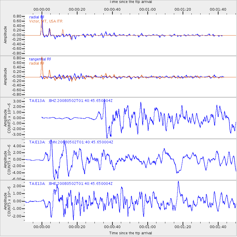
Earthquake location: Andreanof Islands, Aleutian Is.
Earthquake latitude/longitude: 51.9/-177.5
Earthquake time(UTC): 2008/05/02 (123) 01:33:37 GMT
Earthquake Depth: 14 km
Earthquake Magnitude: 6.3 MB, 6.8 MS, 6.6 MW, 6.6 MW
Earthquake Catalog/Contributor: WHDF/NEIC
Network: TA USArray Transportable Network (new EarthScope stations)
Station: E13A Victor, MT, USA
Lat/Lon: 46.44 N/114.19 W
Elevation: 1257 m
Distance: 40.6 deg
Az: 71.689 deg
Baz: 301.645 deg
Ray Param: 0.07428865
Estimated Moho Depth: 41.5 km
Estimated Crust Vp/Vs: 1.62
Assumed Crust Vp: 6.622 km/s
Estimated Crust Vs: 4.081 km/s
Estimated Crust Poisson's Ratio: 0.19
Radial Match: 93.3576 %
Radial Bump: 359
Transverse Match: 71.659424 %
Transverse Bump: 400
SOD ConfigId: 2504
Insert Time: 2010-03-06 15:54:17.720 +0000
GWidth: 2.5
Max Bumps: 400
Tol: 0.001

Signal To Noise

ChannelStoNSTALTA
TA:E13A: :BHN:20080502T01:40:45.650004Z13.5595511.0955017E-68.0791885E-8
TA:E13A: :BHE:20080502T01:40:45.650004Z3.89390373.8953135E-71.000362E-7
TA:E13A: :BHZ:20080502T01:40:45.650004Z6.31244475.37276E-78.511377E-8
Arrivals
Ps4.2 SECOND
PpPs15 SECOND
PsPs/PpSs19 SECOND