You are here: Home > Network List > TA - USArray Transportable Network (new EarthScope stations) Stations List
> Station E13A Victor, MT, USA > Earthquake Result Viewer
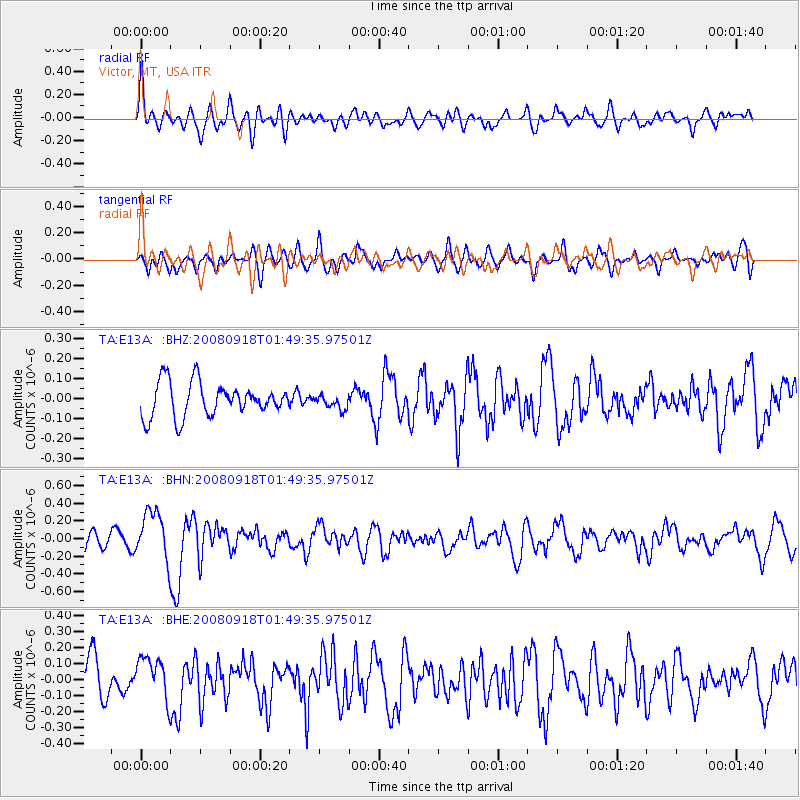
E13A Victor, MT, USA - Earthquake Result Viewer
*The percent match for this event was below the threshold and hence no stack was calculated.
| Earthquake location: |
Central East Pacific Rise |
| Earthquake latitude/longitude: |
-4.6/-106.0 |
| Earthquake time(UTC): |
2008/09/18 (262) 01:41:02 GMT |
| Earthquake Depth: |
10 km |
| Earthquake Magnitude: |
5.5 MB, 5.7 MS, 6.0 MW, 6.0 MW |
| Earthquake Catalog/Contributor: |
WHDF/NEIC |
|
| Network: |
TA USArray Transportable Network (new EarthScope stations) |
| Station: |
E13A Victor, MT, USA |
| Lat/Lon: |
46.44 N/114.19 W |
| Elevation: |
1257 m |
|
| Distance: |
51.3 deg |
| Az: |
352.749 deg |
| Baz: |
169.517 deg |
| Ray Param: |
$rayparam |
*The percent match for this event was below the threshold and hence was not used in the summary stack. |
|
| Radial Match: |
65.811005 % |
| Radial Bump: |
400 |
| Transverse Match: |
57.04354 % |
| Transverse Bump: |
400 |
| SOD ConfigId: |
2560 |
| Insert Time: |
2010-03-06 15:54:47.795 +0000 |
| GWidth: |
2.5 |
| Max Bumps: |
400 |
| Tol: |
0.001 |
|
Signal To Noise
| Channel | StoN | STA | LTA |
| TA:E13A: :BHN:20080918T01:49:35.97501Z | 2.7385519 | 2.7823899E-7 | 1.0160077E-7 |
| TA:E13A: :BHE:20080918T01:49:35.97501Z | 1.4900266 | 1.3461845E-7 | 9.034633E-8 |
| TA:E13A: :BHZ:20080918T01:49:35.97501Z | 0.40237975 | 3.4088117E-8 | 8.4716284E-8 |
| Arrivals |
| Ps | |
| PpPs | |
| PsPs/PpSs | |


