You are here: Home > Network List > TA - USArray Transportable Network (new EarthScope stations) Stations List
> Station E13A Victor, MT, USA > Earthquake Result Viewer
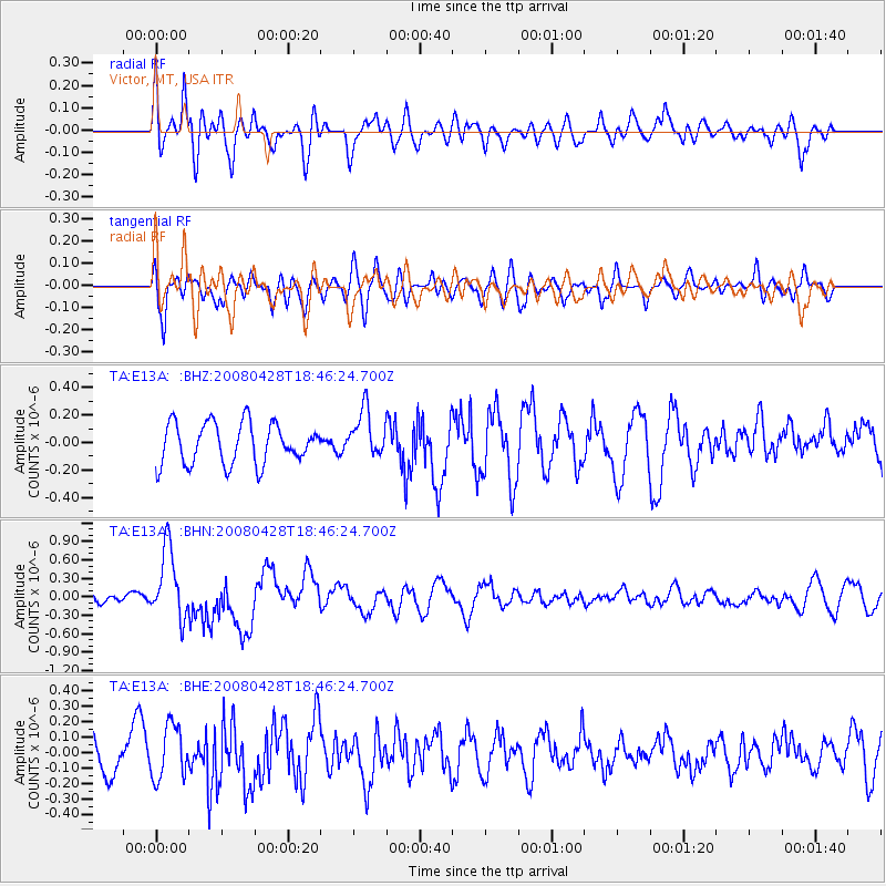
E13A Victor, MT, USA - Earthquake Result Viewer
*The percent match for this event was below the threshold and hence no stack was calculated.
| Earthquake location: |
Vanuatu Islands |
| Earthquake latitude/longitude: |
-19.9/169.0 |
| Earthquake time(UTC): |
2008/04/28 (119) 18:33:34 GMT |
| Earthquake Depth: |
32 km |
| Earthquake Magnitude: |
6.2 MB, 6.2 MS, 6.4 MW, 6.4 MW |
| Earthquake Catalog/Contributor: |
WHDF/NEIC |
|
| Network: |
TA USArray Transportable Network (new EarthScope stations) |
| Station: |
E13A Victor, MT, USA |
| Lat/Lon: |
46.44 N/114.19 W |
| Elevation: |
1257 m |
|
| Distance: |
95.6 deg |
| Az: |
42.578 deg |
| Baz: |
246.996 deg |
| Ray Param: |
$rayparam |
*The percent match for this event was below the threshold and hence was not used in the summary stack. |
|
| Radial Match: |
59.208786 % |
| Radial Bump: |
400 |
| Transverse Match: |
55.747776 % |
| Transverse Bump: |
400 |
| SOD ConfigId: |
2504 |
| Insert Time: |
2010-03-06 15:54:55.883 +0000 |
| GWidth: |
2.5 |
| Max Bumps: |
400 |
| Tol: |
0.001 |
|
Signal To Noise
| Channel | StoN | STA | LTA |
| TA:E13A: :BHN:20080428T18:46:24.700Z | 4.5192637 | 5.7394647E-7 | 1.27E-7 |
| TA:E13A: :BHE:20080428T18:46:24.700Z | 1.5385238 | 1.7347742E-7 | 1.1275575E-7 |
| TA:E13A: :BHZ:20080428T18:46:24.700Z | 1.1736003 | 1.7235772E-7 | 1.4686236E-7 |
| Arrivals |
| Ps | |
| PpPs | |
| PsPs/PpSs | |


