You are here: Home > Network List > TA - USArray Transportable Network (new EarthScope stations) Stations List
> Station E13A Victor, MT, USA > Earthquake Result Viewer
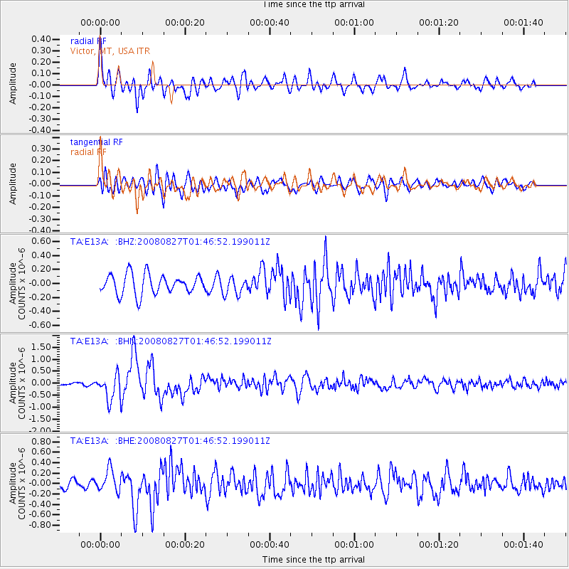
E13A Victor, MT, USA - Earthquake Result Viewer
*The percent match for this event was below the threshold and hence no stack was calculated.
| Earthquake location: |
Lake Baykal Region, Russia |
| Earthquake latitude/longitude: |
51.6/104.2 |
| Earthquake time(UTC): |
2008/08/27 (240) 01:35:32 GMT |
| Earthquake Depth: |
16 km |
| Earthquake Magnitude: |
5.8 MB, 6.2 MS, 6.2 MW, 6.2 MW |
| Earthquake Catalog/Contributor: |
WHDF/NEIC |
|
| Network: |
TA USArray Transportable Network (new EarthScope stations) |
| Station: |
E13A Victor, MT, USA |
| Lat/Lon: |
46.44 N/114.19 W |
| Elevation: |
1257 m |
|
| Distance: |
76.9 deg |
| Az: |
26.134 deg |
| Baz: |
336.596 deg |
| Ray Param: |
$rayparam |
*The percent match for this event was below the threshold and hence was not used in the summary stack. |
|
| Radial Match: |
78.09995 % |
| Radial Bump: |
400 |
| Transverse Match: |
71.74495 % |
| Transverse Bump: |
400 |
| SOD ConfigId: |
2504 |
| Insert Time: |
2010-03-06 15:55:17.927 +0000 |
| GWidth: |
2.5 |
| Max Bumps: |
400 |
| Tol: |
0.001 |
|
Signal To Noise
| Channel | StoN | STA | LTA |
| TA:E13A: :BHN:20080827T01:46:52.199011Z | 5.4487762 | 5.507178E-7 | 1.01071834E-7 |
| TA:E13A: :BHE:20080827T01:46:52.199011Z | 2.55288 | 2.1700235E-7 | 8.500295E-8 |
| TA:E13A: :BHZ:20080827T01:46:52.199011Z | 0.8974351 | 1.2692892E-7 | 1.4143521E-7 |
| Arrivals |
| Ps | |
| PpPs | |
| PsPs/PpSs | |


