You are here: Home > Network List > TA - USArray Transportable Network (new EarthScope stations) Stations List
> Station E13A Victor, MT, USA > Earthquake Result Viewer
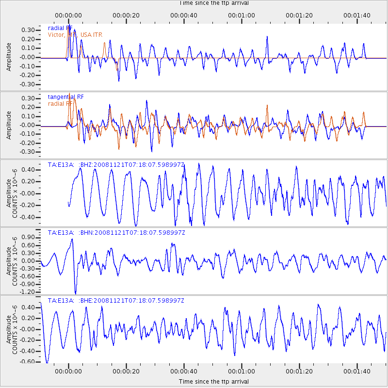
E13A Victor, MT, USA - Earthquake Result Viewer
*The percent match for this event was below the threshold and hence no stack was calculated.
| Earthquake location: |
Solomon Islands |
| Earthquake latitude/longitude: |
-8.9/159.6 |
| Earthquake time(UTC): |
2008/11/21 (326) 07:05:34 GMT |
| Earthquake Depth: |
118 km |
| Earthquake Magnitude: |
6.0 MB, 6.1 MW, 6.0 MW |
| Earthquake Catalog/Contributor: |
WHDF/NEIC |
|
| Network: |
TA USArray Transportable Network (new EarthScope stations) |
| Station: |
E13A Victor, MT, USA |
| Lat/Lon: |
46.44 N/114.19 W |
| Elevation: |
1257 m |
|
| Distance: |
93.8 deg |
| Az: |
43.756 deg |
| Baz: |
261.156 deg |
| Ray Param: |
$rayparam |
*The percent match for this event was below the threshold and hence was not used in the summary stack. |
|
| Radial Match: |
51.044415 % |
| Radial Bump: |
400 |
| Transverse Match: |
52.987274 % |
| Transverse Bump: |
400 |
| SOD ConfigId: |
2658 |
| Insert Time: |
2010-03-06 15:55:31.206 +0000 |
| GWidth: |
2.5 |
| Max Bumps: |
400 |
| Tol: |
0.001 |
|
Signal To Noise
| Channel | StoN | STA | LTA |
| TA:E13A: :BHN:20081121T07:18:07.598997Z | 3.7549677 | 5.8058276E-7 | 1.5461725E-7 |
| TA:E13A: :BHE:20081121T07:18:07.598997Z | 0.76362664 | 2.596533E-7 | 3.400265E-7 |
| TA:E13A: :BHZ:20081121T07:18:07.598997Z | 0.743332 | 2.1983324E-7 | 2.957403E-7 |
| Arrivals |
| Ps | |
| PpPs | |
| PsPs/PpSs | |


