You are here: Home > Network List > TA - USArray Transportable Network (new EarthScope stations) Stations List
> Station E13A Victor, MT, USA > Earthquake Result Viewer
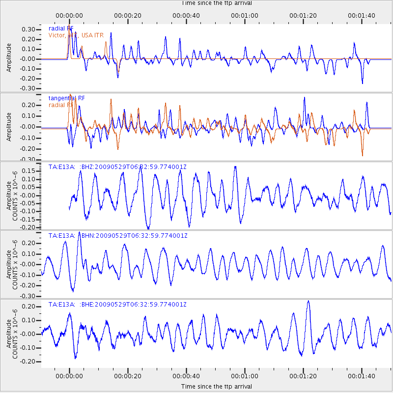
E13A Victor, MT, USA - Earthquake Result Viewer
*The percent match for this event was below the threshold and hence no stack was calculated.
| Earthquake location: |
Vanuatu Islands |
| Earthquake latitude/longitude: |
-17.0/168.3 |
| Earthquake time(UTC): |
2009/05/29 (149) 06:20:14 GMT |
| Earthquake Depth: |
13 km |
| Earthquake Magnitude: |
5.5 MB, 5.5 MS, 5.7 MW, 5.6 MW |
| Earthquake Catalog/Contributor: |
WHDF/NEIC |
|
| Network: |
TA USArray Transportable Network (new EarthScope stations) |
| Station: |
E13A Victor, MT, USA |
| Lat/Lon: |
46.44 N/114.19 W |
| Elevation: |
1257 m |
|
| Distance: |
93.8 deg |
| Az: |
42.578 deg |
| Baz: |
249.402 deg |
| Ray Param: |
$rayparam |
*The percent match for this event was below the threshold and hence was not used in the summary stack. |
|
| Radial Match: |
48.63989 % |
| Radial Bump: |
400 |
| Transverse Match: |
62.569897 % |
| Transverse Bump: |
400 |
| SOD ConfigId: |
2648 |
| Insert Time: |
2010-03-06 15:55:33.564 +0000 |
| GWidth: |
2.5 |
| Max Bumps: |
400 |
| Tol: |
0.001 |
|
Signal To Noise
| Channel | StoN | STA | LTA |
| TA:E13A: :BHN:20090529T06:32:59.774001Z | 2.04962 | 1.763783E-7 | 8.605414E-8 |
| TA:E13A: :BHE:20090529T06:32:59.774001Z | 1.8812964 | 1.0176529E-7 | 5.409317E-8 |
| TA:E13A: :BHZ:20090529T06:32:59.774001Z | 0.98495334 | 8.0262005E-8 | 8.1488125E-8 |
| Arrivals |
| Ps | |
| PpPs | |
| PsPs/PpSs | |


