You are here: Home > Network List > TA - USArray Transportable Network (new EarthScope stations) Stations List
> Station E13A Victor, MT, USA > Earthquake Result Viewer
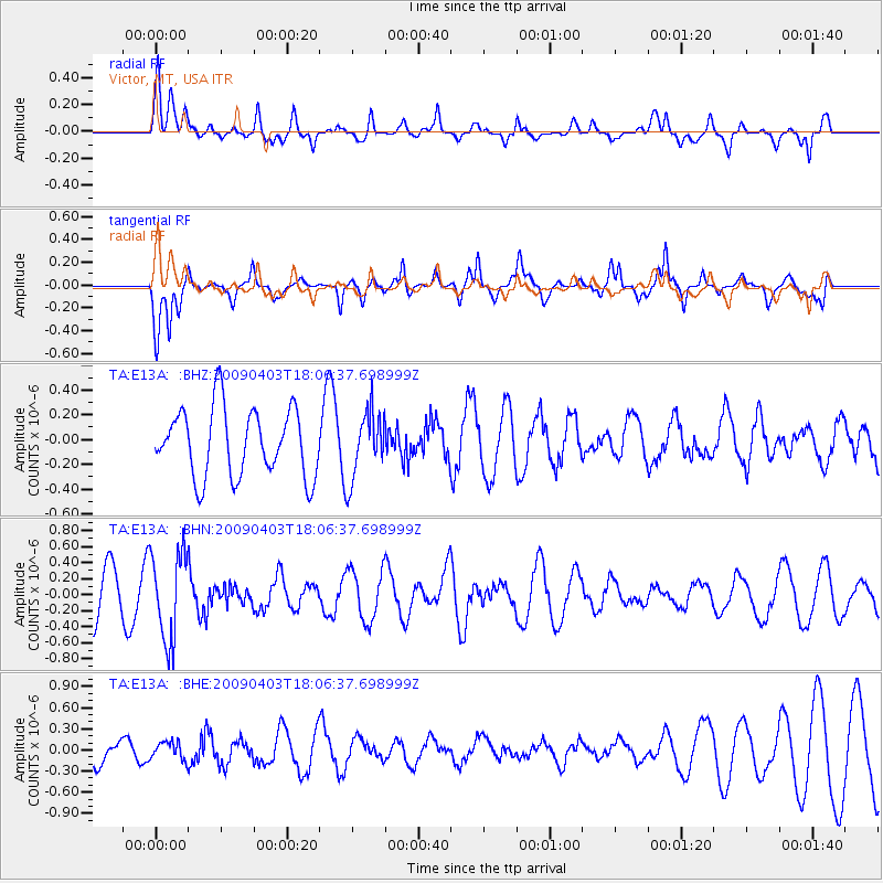
E13A Victor, MT, USA - Earthquake Result Viewer
*The percent match for this event was below the threshold and hence no stack was calculated.
| Earthquake location: |
Catamarca Province, Argentina |
| Earthquake latitude/longitude: |
-27.8/-66.6 |
| Earthquake time(UTC): |
2009/04/03 (093) 17:54:50 GMT |
| Earthquake Depth: |
174 km |
| Earthquake Magnitude: |
5.7 MW, 5.3 MB, 5.7 MW |
| Earthquake Catalog/Contributor: |
WHDF/NEIC |
|
| Network: |
TA USArray Transportable Network (new EarthScope stations) |
| Station: |
E13A Victor, MT, USA |
| Lat/Lon: |
46.44 N/114.19 W |
| Elevation: |
1257 m |
|
| Distance: |
85.6 deg |
| Az: |
329.193 deg |
| Baz: |
139.017 deg |
| Ray Param: |
$rayparam |
*The percent match for this event was below the threshold and hence was not used in the summary stack. |
|
| Radial Match: |
65.924835 % |
| Radial Bump: |
400 |
| Transverse Match: |
59.388866 % |
| Transverse Bump: |
400 |
| SOD ConfigId: |
2658 |
| Insert Time: |
2010-03-06 15:56:13.015 +0000 |
| GWidth: |
2.5 |
| Max Bumps: |
400 |
| Tol: |
0.001 |
|
Signal To Noise
| Channel | StoN | STA | LTA |
| TA:E13A: :BHN:20090403T18:06:37.698999Z | 1.879789 | 5.459293E-7 | 2.904205E-7 |
| TA:E13A: :BHE:20090403T18:06:37.698999Z | 0.57973087 | 1.2587891E-7 | 2.1713336E-7 |
| TA:E13A: :BHZ:20090403T18:06:37.698999Z | 0.98184836 | 2.696031E-7 | 2.745873E-7 |
| Arrivals |
| Ps | |
| PpPs | |
| PsPs/PpSs | |


