You are here: Home > Network List > TA - USArray Transportable Network (new EarthScope stations) Stations List
> Station E13A Victor, MT, USA > Earthquake Result Viewer
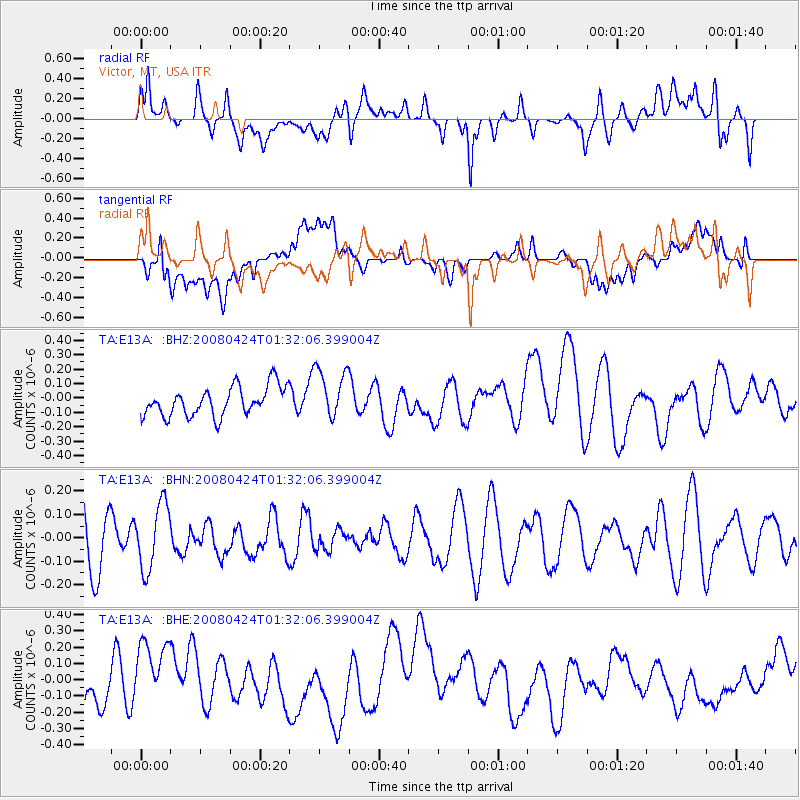
E13A Victor, MT, USA - Earthquake Result Viewer
*The percent match for this event was below the threshold and hence no stack was calculated.
| Earthquake location: |
Loyalty Islands |
| Earthquake latitude/longitude: |
-20.1/168.7 |
| Earthquake time(UTC): |
2008/04/24 (115) 01:19:15 GMT |
| Earthquake Depth: |
35 km |
| Earthquake Magnitude: |
5.7 MW, 5.3 MS, 5.3 MB, 5.6 MW |
| Earthquake Catalog/Contributor: |
WHDF/NEIC |
|
| Network: |
TA USArray Transportable Network (new EarthScope stations) |
| Station: |
E13A Victor, MT, USA |
| Lat/Lon: |
46.44 N/114.19 W |
| Elevation: |
1257 m |
|
| Distance: |
95.8 deg |
| Az: |
42.649 deg |
| Baz: |
247.079 deg |
| Ray Param: |
$rayparam |
*The percent match for this event was below the threshold and hence was not used in the summary stack. |
|
| Radial Match: |
53.39894 % |
| Radial Bump: |
400 |
| Transverse Match: |
43.791462 % |
| Transverse Bump: |
400 |
| SOD ConfigId: |
2504 |
| Insert Time: |
2010-03-06 15:56:18.072 +0000 |
| GWidth: |
2.5 |
| Max Bumps: |
400 |
| Tol: |
0.001 |
|
Signal To Noise
| Channel | StoN | STA | LTA |
| TA:E13A: :BHN:20080424T01:32:06.399004Z | 0.80353004 | 1.4015284E-7 | 1.744214E-7 |
| TA:E13A: :BHE:20080424T01:32:06.399004Z | 2.395572 | 2.2838631E-7 | 9.533686E-8 |
| TA:E13A: :BHZ:20080424T01:32:06.399004Z | 1.7387784 | 1.7659207E-7 | 1.01561E-7 |
| Arrivals |
| Ps | |
| PpPs | |
| PsPs/PpSs | |


