You are here: Home > Network List > TA - USArray Transportable Network (new EarthScope stations) Stations List
> Station E13A Victor, MT, USA > Earthquake Result Viewer
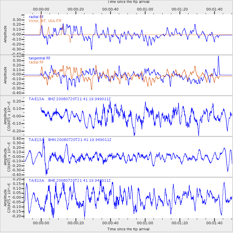
E13A Victor, MT, USA - Earthquake Result Viewer
*The percent match for this event was below the threshold and hence no stack was calculated.
| Earthquake location: |
Bonin Islands, Japan Region |
| Earthquake latitude/longitude: |
27.8/139.6 |
| Earthquake time(UTC): |
2008/07/20 (202) 21:30:29 GMT |
| Earthquake Depth: |
481 km |
| Earthquake Magnitude: |
5.8 MW, 5.1 MB, 5.8 MW |
| Earthquake Catalog/Contributor: |
WHDF/NEIC |
|
| Network: |
TA USArray Transportable Network (new EarthScope stations) |
| Station: |
E13A Victor, MT, USA |
| Lat/Lon: |
46.44 N/114.19 W |
| Elevation: |
1257 m |
|
| Distance: |
80.6 deg |
| Az: |
42.312 deg |
| Baz: |
300.392 deg |
| Ray Param: |
$rayparam |
*The percent match for this event was below the threshold and hence was not used in the summary stack. |
|
| Radial Match: |
47.877922 % |
| Radial Bump: |
400 |
| Transverse Match: |
46.82645 % |
| Transverse Bump: |
400 |
| SOD ConfigId: |
2504 |
| Insert Time: |
2010-03-06 15:56:29.459 +0000 |
| GWidth: |
2.5 |
| Max Bumps: |
400 |
| Tol: |
0.001 |
|
Signal To Noise
| Channel | StoN | STA | LTA |
| TA:E13A: :BHN:20080720T21:41:19.949011Z | 3.5120473 | 2.1977502E-7 | 6.257746E-8 |
| TA:E13A: :BHE:20080720T21:41:19.949011Z | 1.1337478 | 9.707105E-8 | 8.561962E-8 |
| TA:E13A: :BHZ:20080720T21:41:19.949011Z | 2.5543284 | 1.06341645E-7 | 4.163194E-8 |
| Arrivals |
| Ps | |
| PpPs | |
| PsPs/PpSs | |


