You are here: Home > Network List > TA - USArray Transportable Network (new EarthScope stations) Stations List
> Station J26L Joseph Creek, AK, USA > Earthquake Result Viewer
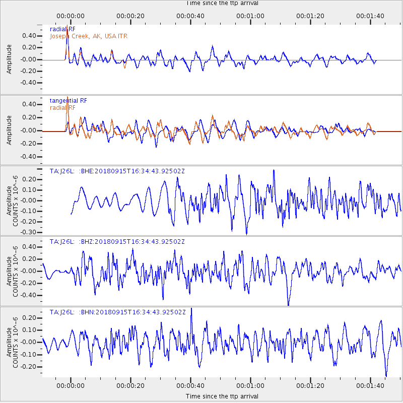
J26L Joseph Creek, AK, USA - Earthquake Result Viewer
*The percent match for this event was below the threshold and hence no stack was calculated.
| Earthquake location: |
Ryukyu Islands, Japan |
| Earthquake latitude/longitude: |
26.6/129.5 |
| Earthquake time(UTC): |
2018/09/15 (258) 16:24:35 GMT |
| Earthquake Depth: |
10 km |
| Earthquake Magnitude: |
5.5 Mww |
| Earthquake Catalog/Contributor: |
NEIC PDE/us |
|
| Network: |
TA USArray Transportable Network (new EarthScope stations) |
| Station: |
J26L Joseph Creek, AK, USA |
| Lat/Lon: |
64.50 N/143.56 W |
| Elevation: |
1144 m |
|
| Distance: |
65.0 deg |
| Az: |
28.471 deg |
| Baz: |
279.463 deg |
| Ray Param: |
$rayparam |
*The percent match for this event was below the threshold and hence was not used in the summary stack. |
|
| Radial Match: |
64.253586 % |
| Radial Bump: |
400 |
| Transverse Match: |
65.081894 % |
| Transverse Bump: |
400 |
| SOD ConfigId: |
13570011 |
| Insert Time: |
2019-05-01 06:29:42.876 +0000 |
| GWidth: |
2.5 |
| Max Bumps: |
400 |
| Tol: |
0.001 |
|
Signal To Noise
| Channel | StoN | STA | LTA |
| TA:J26L: :BHZ:20180915T16:34:43.92502Z | 1.8454012 | 1.4760454E-7 | 7.998507E-8 |
| TA:J26L: :BHN:20180915T16:34:43.92502Z | 1.6360455 | 6.795475E-8 | 4.1535976E-8 |
| TA:J26L: :BHE:20180915T16:34:43.92502Z | 2.6397693 | 1.4887054E-7 | 5.6395283E-8 |
| Arrivals |
| Ps | |
| PpPs | |
| PsPs/PpSs | |


