T28A Walsh, CO, USA - Earthquake Result Viewer
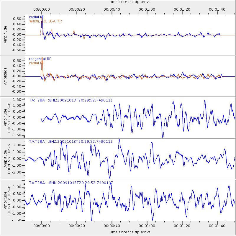
Earthquake location: Fox Islands, Aleutian Islands
Earthquake latitude/longitude: 52.6/-167.1
Earthquake time(UTC): 2009/10/13 (286) 20:21:53 GMT
Earthquake Depth: 14 km
Earthquake Magnitude: 5.9 MB, 6.4 MS, 6.4 MW, 6.4 MW
Earthquake Catalog/Contributor: WHDF/NEIC
Network: TA USArray Transportable Network (new EarthScope stations)
Station: T28A Walsh, CO, USA
Lat/Lon: 37.12 N/102.11 W
Elevation: 1148 m
Distance: 47.0 deg
Az: 82.231 deg
Baz: 310.886 deg
Ray Param: 0.07028165
Estimated Moho Depth: 46.5 km
Estimated Crust Vp/Vs: 1.60
Assumed Crust Vp: 6.306 km/s
Estimated Crust Vs: 3.941 km/s
Estimated Crust Poisson's Ratio: 0.18
Radial Match: 90.93019 %
Radial Bump: 264
Transverse Match: 81.06382 %
Transverse Bump: 400
SOD ConfigId: 2622
Insert Time: 2010-03-06 15:57:16.436 +0000
GWidth: 2.5
Max Bumps: 400
Tol: 0.001

Signal To Noise

ChannelStoNSTALTA
TA:T28A: :BHZ:20091013T20:29:52.749011Z1.823564.0293253E-72.209593E-7
TA:T28A: :BHN:20091013T20:29:52.749011Z1.61848522.893075E-71.78752E-7
TA:T28A: :BHE:20091013T20:29:52.749011Z1.75439192.8686276E-71.6351122E-7
Arrivals
Ps4.7 SECOND
PpPs18 SECOND
PsPs/PpSs23 SECOND