T28A Walsh, CO, USA - Earthquake Result Viewer
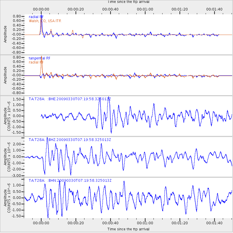
Earthquake location: Kodiak Island Region, Alaska
Earthquake latitude/longitude: 56.5/-152.7
Earthquake time(UTC): 2009/03/30 (089) 07:13:07 GMT
Earthquake Depth: 21 km
Earthquake Magnitude: 5.9 MB, 5.9 MS, 5.9 MW, 5.9 MW
Earthquake Catalog/Contributor: WHDF/NEIC
Network: TA USArray Transportable Network (new EarthScope stations)
Station: T28A Walsh, CO, USA
Lat/Lon: 37.12 N/102.11 W
Elevation: 1148 m
Distance: 38.6 deg
Az: 98.228 deg
Baz: 316.704 deg
Ray Param: 0.075420305
Estimated Moho Depth: 45.25 km
Estimated Crust Vp/Vs: 1.75
Assumed Crust Vp: 6.306 km/s
Estimated Crust Vs: 3.593 km/s
Estimated Crust Poisson's Ratio: 0.26
Radial Match: 90.36433 %
Radial Bump: 293
Transverse Match: 75.94539 %
Transverse Bump: 400
SOD ConfigId: 2658
Insert Time: 2010-03-06 15:57:28.523 +0000
GWidth: 2.5
Max Bumps: 400
Tol: 0.001

Signal To Noise

ChannelStoNSTALTA
TA:T28A: :BHZ:20090330T07:19:58.325013Z11.2950551.5245377E-61.349739E-7
TA:T28A: :BHN:20090330T07:19:58.325013Z3.6663967.003442E-71.9101707E-7
TA:T28A: :BHE:20090330T07:19:58.325013Z4.3262137.4752893E-71.727906E-7
Arrivals
Ps5.8 SECOND
PpPs18 SECOND
PsPs/PpSs24 SECOND