T28A Walsh, CO, USA - Earthquake Result Viewer
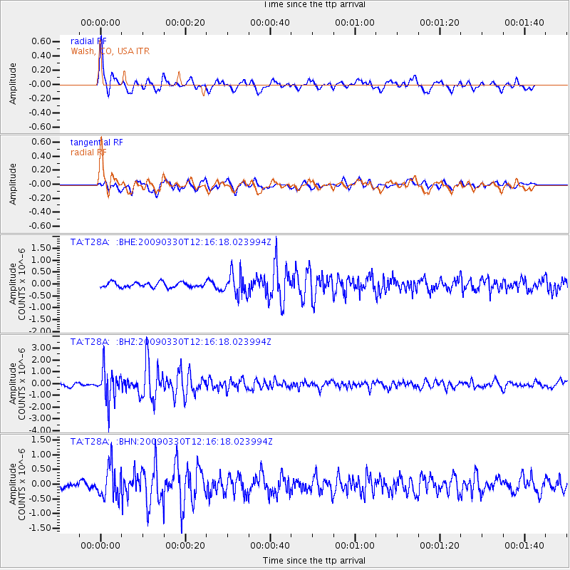
Earthquake location: Andreanof Islands, Aleutian Is.
Earthquake latitude/longitude: 51.5/-178.3
Earthquake time(UTC): 2009/03/30 (089) 12:07:28 GMT
Earthquake Depth: 31 km
Earthquake Magnitude: 6.0 MB, 5.5 MS, 5.7 MW, 5.7 MW
Earthquake Catalog/Contributor: WHDF/NEIC
Network: TA USArray Transportable Network (new EarthScope stations)
Station: T28A Walsh, CO, USA
Lat/Lon: 37.12 N/102.11 W
Elevation: 1148 m
Distance: 53.9 deg
Az: 73.774 deg
Baz: 311.384 deg
Ray Param: 0.065716684
Estimated Moho Depth: 28.75 km
Estimated Crust Vp/Vs: 1.60
Assumed Crust Vp: 6.306 km/s
Estimated Crust Vs: 3.941 km/s
Estimated Crust Poisson's Ratio: 0.18
Radial Match: 82.83695 %
Radial Bump: 400
Transverse Match: 67.93852 %
Transverse Bump: 400
SOD ConfigId: 2658
Insert Time: 2010-03-06 15:57:30.732 +0000
GWidth: 2.5
Max Bumps: 400
Tol: 0.001

Signal To Noise

ChannelStoNSTALTA
TA:T28A: :BHZ:20090330T12:16:18.023994Z8.602681.3009842E-61.512301E-7
TA:T28A: :BHN:20090330T12:16:18.023994Z2.61730225.4939756E-72.0990987E-7
TA:T28A: :BHE:20090330T12:16:18.023994Z4.51506044.7435498E-71.050606E-7
Arrivals
Ps2.9 SECOND
PpPs11 SECOND
PsPs/PpSs14 SECOND