You are here: Home > Network List > TA - USArray Transportable Network (new EarthScope stations) Stations List
> Station G16K Koyuk River, AK, USA > Earthquake Result Viewer
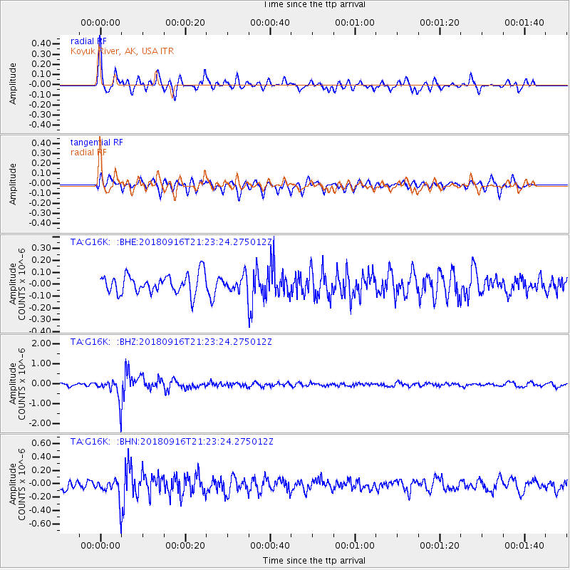
G16K Koyuk River, AK, USA - Earthquake Result Viewer
*The percent match for this event was below the threshold and hence no stack was calculated.
| Earthquake location: |
South Of Fiji Islands |
| Earthquake latitude/longitude: |
-25.5/178.2 |
| Earthquake time(UTC): |
2018/09/16 (259) 21:11:48 GMT |
| Earthquake Depth: |
570 km |
| Earthquake Magnitude: |
6.5 Mww |
| Earthquake Catalog/Contributor: |
NEIC PDE/us |
|
| Network: |
TA USArray Transportable Network (new EarthScope stations) |
| Station: |
G16K Koyuk River, AK, USA |
| Lat/Lon: |
65.39 N/162.35 W |
| Elevation: |
169 m |
|
| Distance: |
91.8 deg |
| Az: |
8.008 deg |
| Baz: |
197.507 deg |
| Ray Param: |
$rayparam |
*The percent match for this event was below the threshold and hence was not used in the summary stack. |
|
| Radial Match: |
77.97662 % |
| Radial Bump: |
379 |
| Transverse Match: |
68.813866 % |
| Transverse Bump: |
400 |
| SOD ConfigId: |
13570011 |
| Insert Time: |
2019-05-01 06:36:43.082 +0000 |
| GWidth: |
2.5 |
| Max Bumps: |
400 |
| Tol: |
0.001 |
|
Signal To Noise
| Channel | StoN | STA | LTA |
| TA:G16K: :BHZ:20180916T21:23:24.275012Z | 9.623989 | 5.8120213E-7 | 6.0390974E-8 |
| TA:G16K: :BHN:20180916T21:23:24.275012Z | 2.4646864 | 1.6880988E-7 | 6.8491424E-8 |
| TA:G16K: :BHE:20180916T21:23:24.275012Z | 1.1556858 | 9.151378E-8 | 7.918569E-8 |
| Arrivals |
| Ps | |
| PpPs | |
| PsPs/PpSs | |


