You are here: Home > Network List > UW - Pacific Northwest Regional Seismic Network Stations List
> Station YACT Amboy, WA, USA > Earthquake Result Viewer
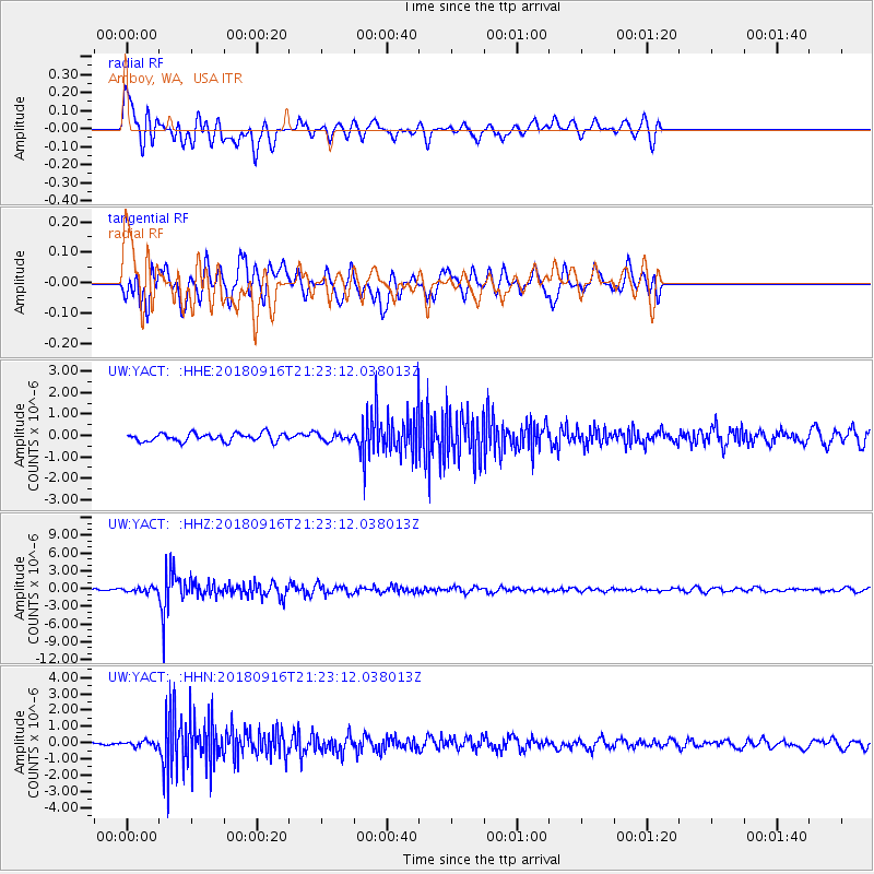
YACT Amboy, WA, USA - Earthquake Result Viewer
*The percent match for this event was below the threshold and hence no stack was calculated.
| Earthquake location: |
South Of Fiji Islands |
| Earthquake latitude/longitude: |
-25.5/178.2 |
| Earthquake time(UTC): |
2018/09/16 (259) 21:11:48 GMT |
| Earthquake Depth: |
570 km |
| Earthquake Magnitude: |
6.5 Mww |
| Earthquake Catalog/Contributor: |
NEIC PDE/us |
|
| Network: |
UW Pacific Northwest Regional Seismic Network |
| Station: |
YACT Amboy, WA, USA |
| Lat/Lon: |
45.93 N/122.42 W |
| Elevation: |
211 m |
|
| Distance: |
89.1 deg |
| Az: |
36.909 deg |
| Baz: |
231.072 deg |
| Ray Param: |
$rayparam |
*The percent match for this event was below the threshold and hence was not used in the summary stack. |
|
| Radial Match: |
71.128204 % |
| Radial Bump: |
400 |
| Transverse Match: |
58.531925 % |
| Transverse Bump: |
400 |
| SOD ConfigId: |
13570011 |
| Insert Time: |
2019-05-01 06:38:50.343 +0000 |
| GWidth: |
2.5 |
| Max Bumps: |
400 |
| Tol: |
0.001 |
|
Signal To Noise
| Channel | StoN | STA | LTA |
| UW:YACT: :HHZ:20180916T21:23:12.038013Z | 2.4553244 | 3.883344E-7 | 1.5816012E-7 |
| UW:YACT: :HHN:20180916T21:23:12.038013Z | 0.93067056 | 1.7033932E-7 | 1.8302859E-7 |
| UW:YACT: :HHE:20180916T21:23:12.038013Z | 0.793551 | 1.479858E-7 | 1.8648555E-7 |
| Arrivals |
| Ps | |
| PpPs | |
| PsPs/PpSs | |


