You are here: Home > Network List > TA - USArray Transportable Network (new EarthScope stations) Stations List
> Station T28A Walsh, CO, USA > Earthquake Result Viewer
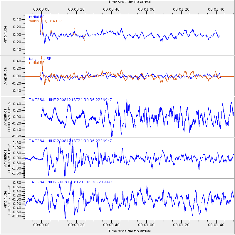
T28A Walsh, CO, USA - Earthquake Result Viewer
*The percent match for this event was below the threshold and hence no stack was calculated.
| Earthquake location: |
Near Coast Of Central Chile |
| Earthquake latitude/longitude: |
-32.5/-71.7 |
| Earthquake time(UTC): |
2008/12/18 (353) 21:19:28 GMT |
| Earthquake Depth: |
18 km |
| Earthquake Magnitude: |
5.8 MB, 6.0 MS, 6.2 MW, 6.1 MW |
| Earthquake Catalog/Contributor: |
WHDF/NEIC |
|
| Network: |
TA USArray Transportable Network (new EarthScope stations) |
| Station: |
T28A Walsh, CO, USA |
| Lat/Lon: |
37.12 N/102.11 W |
| Elevation: |
1148 m |
|
| Distance: |
74.8 deg |
| Az: |
335.231 deg |
| Baz: |
153.697 deg |
| Ray Param: |
$rayparam |
*The percent match for this event was below the threshold and hence was not used in the summary stack. |
|
| Radial Match: |
72.91859 % |
| Radial Bump: |
400 |
| Transverse Match: |
55.187458 % |
| Transverse Bump: |
400 |
| SOD ConfigId: |
2658 |
| Insert Time: |
2010-03-06 15:57:58.995 +0000 |
| GWidth: |
2.5 |
| Max Bumps: |
400 |
| Tol: |
0.001 |
|
Signal To Noise
| Channel | StoN | STA | LTA |
| TA:T28A: :BHZ:20081218T21:30:36.223994Z | 5.704582 | 7.744903E-7 | 1.3576636E-7 |
| TA:T28A: :BHN:20081218T21:30:36.223994Z | 1.9771175 | 3.312001E-7 | 1.6751665E-7 |
| TA:T28A: :BHE:20081218T21:30:36.223994Z | 0.7797983 | 1.2669283E-7 | 1.6246872E-7 |
| Arrivals |
| Ps | |
| PpPs | |
| PsPs/PpSs | |


