T27A Campo, CO, USA - Earthquake Result Viewer
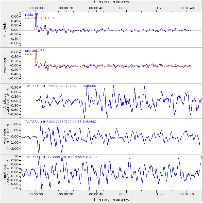
Earthquake location: Kodiak Island Region, Alaska
Earthquake latitude/longitude: 56.5/-152.7
Earthquake time(UTC): 2009/03/30 (089) 07:13:07 GMT
Earthquake Depth: 21 km
Earthquake Magnitude: 5.9 MB, 5.9 MS, 5.9 MW, 5.9 MW
Earthquake Catalog/Contributor: WHDF/NEIC
Network: TA USArray Transportable Network (new EarthScope stations)
Station: T27A Campo, CO, USA
Lat/Lon: 37.06 N/102.72 W
Elevation: 1366 m
Distance: 38.3 deg
Az: 98.862 deg
Baz: 316.835 deg
Ray Param: 0.07558772
Estimated Moho Depth: 17.0 km
Estimated Crust Vp/Vs: 1.60
Assumed Crust Vp: 6.306 km/s
Estimated Crust Vs: 3.941 km/s
Estimated Crust Poisson's Ratio: 0.18
Radial Match: 92.74454 %
Radial Bump: 337
Transverse Match: 61.275414 %
Transverse Bump: 400
SOD ConfigId: 2658
Insert Time: 2010-03-06 15:58:43.538 +0000
GWidth: 2.5
Max Bumps: 400
Tol: 0.001

Signal To Noise

ChannelStoNSTALTA
TA:T27A: :BHZ:20090330T07:19:55.898988Z9.8461481.4446317E-61.467205E-7
TA:T27A: :BHN:20090330T07:19:55.898988Z4.8414746.8852205E-71.4221331E-7
TA:T27A: :BHE:20090330T07:19:55.898988Z3.04406176.222122E-72.0440197E-7
Arrivals
Ps1.7 SECOND
PpPs6.5 SECOND
PsPs/PpSs8.2 SECOND