T27A Campo, CO, USA - Earthquake Result Viewer
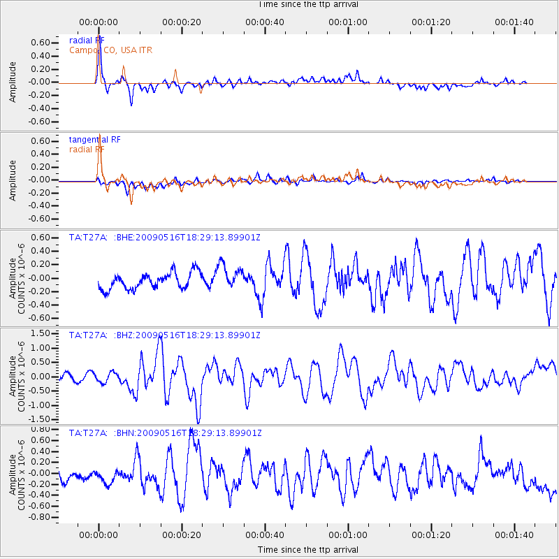
Earthquake location: Kodiak Island Region, Alaska
Earthquake latitude/longitude: 56.4/-152.4
Earthquake time(UTC): 2009/05/16 (136) 18:22:25 GMT
Earthquake Depth: 9.7 km
Earthquake Magnitude: 5.9 MS, 5.4 MB, 5.9 MW, 5.8 MW
Earthquake Catalog/Contributor: WHDF/NEIC
Network: TA USArray Transportable Network (new EarthScope stations)
Station: T27A Campo, CO, USA
Lat/Lon: 37.06 N/102.72 W
Elevation: 1366 m
Distance: 38.2 deg
Az: 99.02 deg
Baz: 316.701 deg
Ray Param: 0.075726904
Estimated Moho Depth: 16.75 km
Estimated Crust Vp/Vs: 1.60
Assumed Crust Vp: 6.306 km/s
Estimated Crust Vs: 3.941 km/s
Estimated Crust Poisson's Ratio: 0.18
Radial Match: 85.99035 %
Radial Bump: 400
Transverse Match: 65.69317 %
Transverse Bump: 400
SOD ConfigId: 2760
Insert Time: 2010-03-06 15:58:53.988 +0000
GWidth: 2.5
Max Bumps: 400
Tol: 0.001

Signal To Noise

ChannelStoNSTALTA
TA:T27A: :BHZ:20090516T18:29:13.89901Z1.64458021.7183478E-71.04485494E-7
TA:T27A: :BHN:20090516T18:29:13.89901Z1.28485251.7563443E-71.3669617E-7
TA:T27A: :BHE:20090516T18:29:13.89901Z1.5300281.837424E-71.2009087E-7
Arrivals
Ps1.7 SECOND
PpPs6.4 SECOND
PsPs/PpSs8.1 SECOND