You are here: Home > Network List > TA - USArray Transportable Network (new EarthScope stations) Stations List
> Station T27A Campo, CO, USA > Earthquake Result Viewer
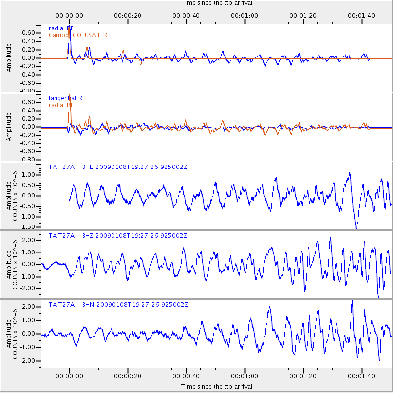
T27A Campo, CO, USA - Earthquake Result Viewer
*The percent match for this event was below the threshold and hence no stack was calculated.
| Earthquake location: |
Costa Rica |
| Earthquake latitude/longitude: |
10.2/-84.2 |
| Earthquake time(UTC): |
2009/01/08 (008) 19:21:35 GMT |
| Earthquake Depth: |
14 km |
| Earthquake Magnitude: |
5.7 MB, 6.0 MS, 6.1 MW, 6.1 MW |
| Earthquake Catalog/Contributor: |
WHDF/NEIC |
|
| Network: |
TA USArray Transportable Network (new EarthScope stations) |
| Station: |
T27A Campo, CO, USA |
| Lat/Lon: |
37.06 N/102.72 W |
| Elevation: |
1366 m |
|
| Distance: |
31.6 deg |
| Az: |
330.964 deg |
| Baz: |
143.319 deg |
| Ray Param: |
$rayparam |
*The percent match for this event was below the threshold and hence was not used in the summary stack. |
|
| Radial Match: |
79.65095 % |
| Radial Bump: |
386 |
| Transverse Match: |
55.44394 % |
| Transverse Bump: |
400 |
| SOD ConfigId: |
2834 |
| Insert Time: |
2010-03-06 15:58:57.951 +0000 |
| GWidth: |
2.5 |
| Max Bumps: |
400 |
| Tol: |
0.001 |
|
Signal To Noise
| Channel | StoN | STA | LTA |
| TA:T27A: :BHZ:20090108T19:27:26.925002Z | 3.3937433 | 5.782697E-7 | 1.7039288E-7 |
| TA:T27A: :BHN:20090108T19:27:26.925002Z | 1.154849 | 3.7152324E-7 | 3.217072E-7 |
| TA:T27A: :BHE:20090108T19:27:26.925002Z | 0.7730624 | 2.4068066E-7 | 3.1133408E-7 |
| Arrivals |
| Ps | |
| PpPs | |
| PsPs/PpSs | |


