You are here: Home > Network List > TA - USArray Transportable Network (new EarthScope stations) Stations List
> Station T27A Campo, CO, USA > Earthquake Result Viewer
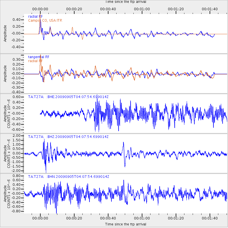
T27A Campo, CO, USA - Earthquake Result Viewer
*The percent match for this event was below the threshold and hence no stack was calculated.
| Earthquake location: |
Southern Peru |
| Earthquake latitude/longitude: |
-15.1/-70.2 |
| Earthquake time(UTC): |
2009/09/05 (248) 03:58:39 GMT |
| Earthquake Depth: |
210 km |
| Earthquake Magnitude: |
5.8 MW, 5.2 MB, 5.8 MW |
| Earthquake Catalog/Contributor: |
WHDF/NEIC |
|
| Network: |
TA USArray Transportable Network (new EarthScope stations) |
| Station: |
T27A Campo, CO, USA |
| Lat/Lon: |
37.06 N/102.72 W |
| Elevation: |
1366 m |
|
| Distance: |
60.2 deg |
| Az: |
330.351 deg |
| Baz: |
143.325 deg |
| Ray Param: |
$rayparam |
*The percent match for this event was below the threshold and hence was not used in the summary stack. |
|
| Radial Match: |
59.83083 % |
| Radial Bump: |
400 |
| Transverse Match: |
50.22075 % |
| Transverse Bump: |
400 |
| SOD ConfigId: |
2622 |
| Insert Time: |
2010-03-06 15:59:13.038 +0000 |
| GWidth: |
2.5 |
| Max Bumps: |
400 |
| Tol: |
0.001 |
|
Signal To Noise
| Channel | StoN | STA | LTA |
| TA:T27A: :BHZ:20090905T04:07:54.699014Z | 6.3509994 | 6.9134103E-7 | 1.08855474E-7 |
| TA:T27A: :BHN:20090905T04:07:54.699014Z | 2.889273 | 2.3108352E-7 | 7.997981E-8 |
| TA:T27A: :BHE:20090905T04:07:54.699014Z | 4.519525 | 2.6940467E-7 | 5.9609064E-8 |
| Arrivals |
| Ps | |
| PpPs | |
| PsPs/PpSs | |


