You are here: Home > Network List > TA - USArray Transportable Network (new EarthScope stations) Stations List
> Station T27A Campo, CO, USA > Earthquake Result Viewer
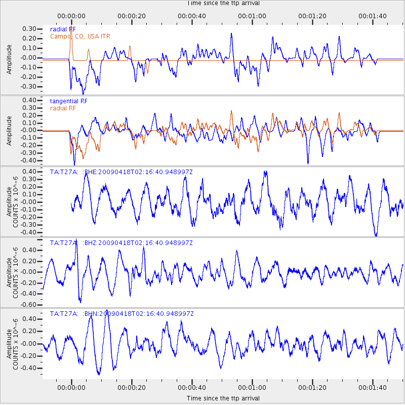
T27A Campo, CO, USA - Earthquake Result Viewer
*The percent match for this event was below the threshold and hence no stack was calculated.
| Earthquake location: |
Kermadec Islands Region |
| Earthquake latitude/longitude: |
-28.9/-177.4 |
| Earthquake time(UTC): |
2009/04/18 (108) 02:03:52 GMT |
| Earthquake Depth: |
65 km |
| Earthquake Magnitude: |
6.0 MB, 5.8 MW, 5.7 MW |
| Earthquake Catalog/Contributor: |
WHDF/NEIC |
|
| Network: |
TA USArray Transportable Network (new EarthScope stations) |
| Station: |
T27A Campo, CO, USA |
| Lat/Lon: |
37.06 N/102.72 W |
| Elevation: |
1366 m |
|
| Distance: |
96.0 deg |
| Az: |
50.883 deg |
| Baz: |
238.248 deg |
| Ray Param: |
$rayparam |
*The percent match for this event was below the threshold and hence was not used in the summary stack. |
|
| Radial Match: |
54.92503 % |
| Radial Bump: |
400 |
| Transverse Match: |
46.909943 % |
| Transverse Bump: |
400 |
| SOD ConfigId: |
2658 |
| Insert Time: |
2010-03-06 15:59:34.317 +0000 |
| GWidth: |
2.5 |
| Max Bumps: |
400 |
| Tol: |
0.001 |
|
Signal To Noise
| Channel | StoN | STA | LTA |
| TA:T27A: :BHZ:20090418T02:16:40.948997Z | 2.407567 | 2.938553E-7 | 1.2205487E-7 |
| TA:T27A: :BHN:20090418T02:16:40.948997Z | 1.4039949 | 1.9411263E-7 | 1.3825736E-7 |
| TA:T27A: :BHE:20090418T02:16:40.948997Z | 0.61715376 | 9.4711005E-8 | 1.534642E-7 |
| Arrivals |
| Ps | |
| PpPs | |
| PsPs/PpSs | |


