You are here: Home > Network List > TA - USArray Transportable Network (new EarthScope stations) Stations List
> Station T27A Campo, CO, USA > Earthquake Result Viewer
T27A Campo, CO, USA - Earthquake Result Viewer
*The percent match for this event was below the threshold and hence no stack was calculated.
| Earthquake location: |
Costa Rica |
| Earthquake latitude/longitude: |
8.5/-83.2 |
| Earthquake time(UTC): |
2009/03/11 (070) 21:03:58 GMT |
| Earthquake Depth: |
17 km |
| Earthquake Magnitude: |
5.7 MB, 5.6 MS, 5.9 MW, 5.8 MW |
| Earthquake Catalog/Contributor: |
WHDF/NEIC |
|
| Network: |
TA USArray Transportable Network (new EarthScope stations) |
| Station: |
T27A Campo, CO, USA |
| Lat/Lon: |
37.06 N/102.72 W |
| Elevation: |
1366 m |
|
| Distance: |
33.5 deg |
| Az: |
331.045 deg |
| Baz: |
143.226 deg |
| Ray Param: |
$rayparam |
*The percent match for this event was below the threshold and hence was not used in the summary stack. |
|
| Radial Match: |
74.14601 % |
| Radial Bump: |
400 |
| Transverse Match: |
52.98125 % |
| Transverse Bump: |
400 |
| SOD ConfigId: |
2658 |
| Insert Time: |
2010-03-06 15:59:40.162 +0000 |
| GWidth: |
2.5 |
| Max Bumps: |
400 |
| Tol: |
0.001 |
|
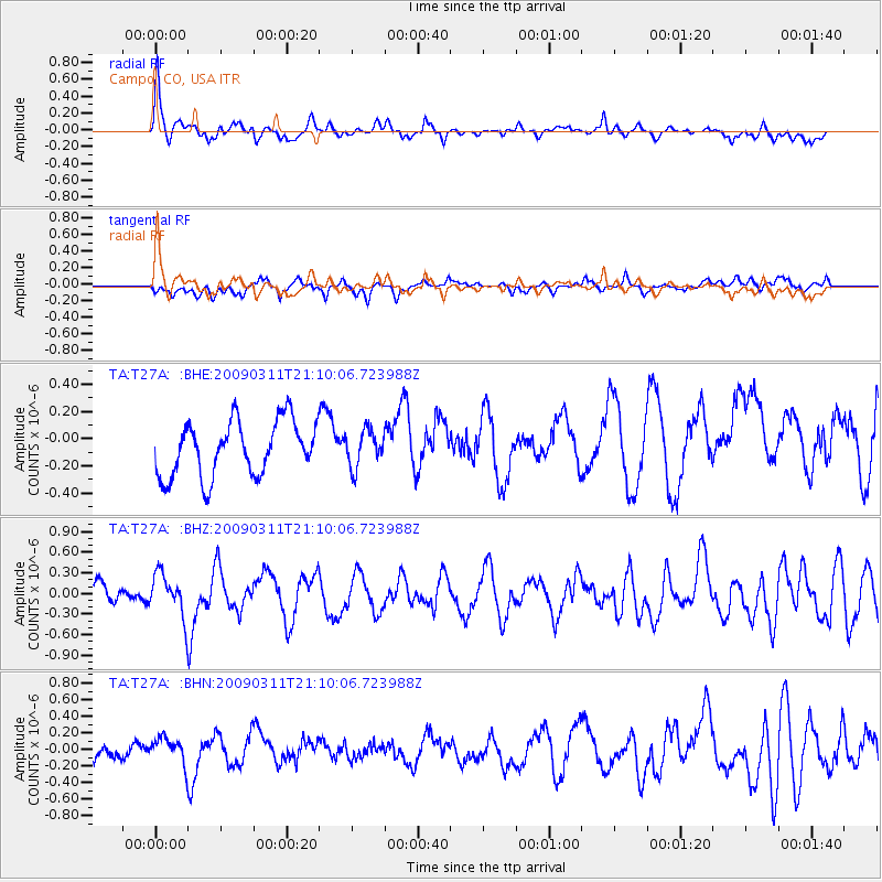
Signal To Noise
| Channel | StoN | STA | LTA |
| TA:T27A: :BHZ:20090311T21:10:06.723988Z | 2.191349 | 3.1372173E-7 | 1.4316373E-7 |
| TA:T27A: :BHN:20090311T21:10:06.723988Z | 1.4186609 | 1.5499096E-7 | 1.0925159E-7 |
| TA:T27A: :BHE:20090311T21:10:06.723988Z | 0.66951805 | 1.3356075E-7 | 1.9948789E-7 |
| Arrivals |
| Ps | |
| PpPs | |
| PsPs/PpSs | |


