You are here: Home > Network List > TA - USArray Transportable Network (new EarthScope stations) Stations List
> Station C16K Lisburne Hills, AK, USA > Earthquake Result Viewer
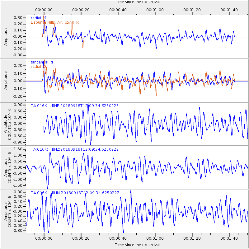
C16K Lisburne Hills, AK, USA - Earthquake Result Viewer
*The percent match for this event was below the threshold and hence no stack was calculated.
| Earthquake location: |
Solomon Islands |
| Earthquake latitude/longitude: |
-8.3/157.2 |
| Earthquake time(UTC): |
2018/09/18 (261) 11:57:52 GMT |
| Earthquake Depth: |
10 km |
| Earthquake Magnitude: |
5.8 Mww |
| Earthquake Catalog/Contributor: |
NEIC PDE/us |
|
| Network: |
TA USArray Transportable Network (new EarthScope stations) |
| Station: |
C16K Lisburne Hills, AK, USA |
| Lat/Lon: |
68.27 N/165.34 W |
| Elevation: |
102 m |
|
| Distance: |
80.9 deg |
| Az: |
13.253 deg |
| Baz: |
217.542 deg |
| Ray Param: |
$rayparam |
*The percent match for this event was below the threshold and hence was not used in the summary stack. |
|
| Radial Match: |
54.358562 % |
| Radial Bump: |
364 |
| Transverse Match: |
49.694065 % |
| Transverse Bump: |
384 |
| SOD ConfigId: |
13570011 |
| Insert Time: |
2019-05-01 06:48:57.438 +0000 |
| GWidth: |
2.5 |
| Max Bumps: |
400 |
| Tol: |
0.001 |
|
Signal To Noise
| Channel | StoN | STA | LTA |
| TA:C16K: :BHZ:20180918T12:09:34.625022Z | 3.1808183 | 8.195117E-7 | 2.5764177E-7 |
| TA:C16K: :BHN:20180918T12:09:34.625022Z | 2.2457724 | 5.538E-7 | 2.4659667E-7 |
| TA:C16K: :BHE:20180918T12:09:34.625022Z | 0.79227084 | 3.1586245E-7 | 3.9867987E-7 |
| Arrivals |
| Ps | |
| PpPs | |
| PsPs/PpSs | |


