You are here: Home > Network List > TA - USArray Transportable Network (new EarthScope stations) Stations List
> Station P17K Kvichak River, AK, USA > Earthquake Result Viewer
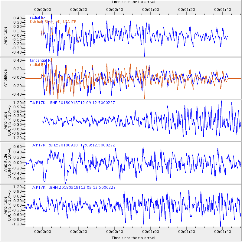
P17K Kvichak River, AK, USA - Earthquake Result Viewer
*The percent match for this event was below the threshold and hence no stack was calculated.
| Earthquake location: |
Solomon Islands |
| Earthquake latitude/longitude: |
-8.3/157.2 |
| Earthquake time(UTC): |
2018/09/18 (261) 11:57:52 GMT |
| Earthquake Depth: |
10 km |
| Earthquake Magnitude: |
5.8 Mww |
| Earthquake Catalog/Contributor: |
NEIC PDE/us |
|
| Network: |
TA USArray Transportable Network (new EarthScope stations) |
| Station: |
P17K Kvichak River, AK, USA |
| Lat/Lon: |
59.20 N/156.44 W |
| Elevation: |
91 m |
|
| Distance: |
76.8 deg |
| Az: |
22.485 deg |
| Baz: |
227.338 deg |
| Ray Param: |
$rayparam |
*The percent match for this event was below the threshold and hence was not used in the summary stack. |
|
| Radial Match: |
70.61164 % |
| Radial Bump: |
400 |
| Transverse Match: |
60.606552 % |
| Transverse Bump: |
400 |
| SOD ConfigId: |
13570011 |
| Insert Time: |
2019-05-01 06:50:47.427 +0000 |
| GWidth: |
2.5 |
| Max Bumps: |
400 |
| Tol: |
0.001 |
|
Signal To Noise
| Channel | StoN | STA | LTA |
| TA:P17K: :BHZ:20180918T12:09:12.500022Z | 3.7426732 | 3.6379856E-7 | 9.720287E-8 |
| TA:P17K: :BHN:20180918T12:09:12.500022Z | 1.7236494 | 2.859981E-7 | 1.6592593E-7 |
| TA:P17K: :BHE:20180918T12:09:12.500022Z | 0.9292935 | 1.4042998E-7 | 1.5111478E-7 |
| Arrivals |
| Ps | |
| PpPs | |
| PsPs/PpSs | |


