You are here: Home > Network List > UW - Pacific Northwest Regional Seismic Network Stations List
> Station LCCR Mulino, OR, USA > Earthquake Result Viewer
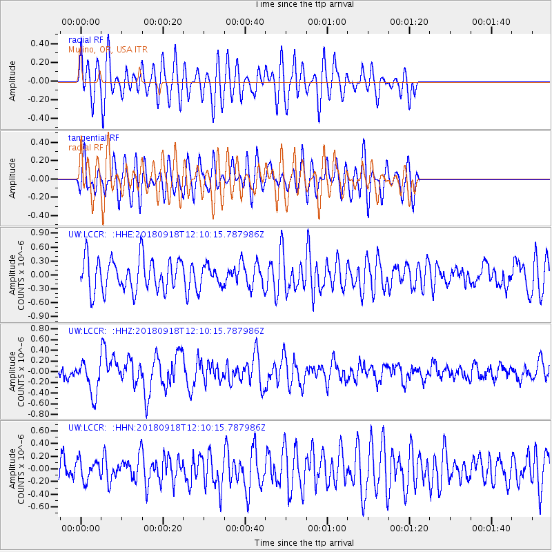
LCCR Mulino, OR, USA - Earthquake Result Viewer
*The percent match for this event was below the threshold and hence no stack was calculated.
| Earthquake location: |
Solomon Islands |
| Earthquake latitude/longitude: |
-8.3/157.2 |
| Earthquake time(UTC): |
2018/09/18 (261) 11:57:52 GMT |
| Earthquake Depth: |
10 km |
| Earthquake Magnitude: |
5.8 Mww |
| Earthquake Catalog/Contributor: |
NEIC PDE/us |
|
| Network: |
UW Pacific Northwest Regional Seismic Network |
| Station: |
LCCR Mulino, OR, USA |
| Lat/Lon: |
45.21 N/122.48 W |
| Elevation: |
273 m |
|
| Distance: |
89.1 deg |
| Az: |
44.181 deg |
| Baz: |
257.313 deg |
| Ray Param: |
$rayparam |
*The percent match for this event was below the threshold and hence was not used in the summary stack. |
|
| Radial Match: |
51.077576 % |
| Radial Bump: |
400 |
| Transverse Match: |
57.73922 % |
| Transverse Bump: |
400 |
| SOD ConfigId: |
13570011 |
| Insert Time: |
2019-05-01 06:51:47.308 +0000 |
| GWidth: |
2.5 |
| Max Bumps: |
400 |
| Tol: |
0.001 |
|
Signal To Noise
| Channel | StoN | STA | LTA |
| UW:LCCR: :HHZ:20180918T12:10:15.787986Z | 2.8742182 | 3.1864502E-7 | 1.108632E-7 |
| UW:LCCR: :HHN:20180918T12:10:15.787986Z | 0.80697167 | 1.605652E-7 | 1.9897253E-7 |
| UW:LCCR: :HHE:20180918T12:10:15.787986Z | 0.58592135 | 2.0598863E-7 | 3.515636E-7 |
| Arrivals |
| Ps | |
| PpPs | |
| PsPs/PpSs | |


