You are here: Home > Network List > TA - USArray Transportable Network (new EarthScope stations) Stations List
> Station J13A Cove Ranch, Picabo, ID, USA > Earthquake Result Viewer
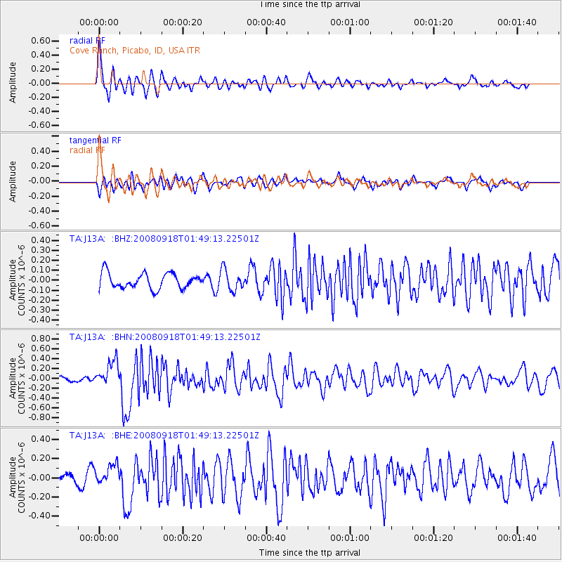
J13A Cove Ranch, Picabo, ID, USA - Earthquake Result Viewer

| Earthquake location: |
Central East Pacific Rise |
| Earthquake latitude/longitude: |
-4.6/-106.0 |
| Earthquake time(UTC): |
2008/09/18 (262) 01:41:02 GMT |
| Earthquake Depth: |
10 km |
| Earthquake Magnitude: |
5.5 MB, 5.7 MS, 6.0 MW, 6.0 MW |
| Earthquake Catalog/Contributor: |
WHDF/NEIC |
|
| Network: |
TA USArray Transportable Network (new EarthScope stations) |
| Station: |
J13A Cove Ranch, Picabo, ID, USA |
| Lat/Lon: |
43.40 N/114.17 W |
| Elevation: |
1552 m |
|
| Distance: |
48.3 deg |
| Az: |
352.021 deg |
| Baz: |
169.057 deg |
| Ray Param: |
0.06944983 |
| Estimated Moho Depth: |
24.5 km |
| Estimated Crust Vp/Vs: |
1.87 |
| Assumed Crust Vp: |
6.291 km/s |
| Estimated Crust Vs: |
3.364 km/s |
| Estimated Crust Poisson's Ratio: |
0.30 |
|
| Radial Match: |
81.68221 % |
| Radial Bump: |
400 |
| Transverse Match: |
74.447716 % |
| Transverse Bump: |
400 |
| SOD ConfigId: |
2560 |
| Insert Time: |
2010-03-06 16:00:56.052 +0000 |
| GWidth: |
2.5 |
| Max Bumps: |
400 |
| Tol: |
0.001 |
|
Signal To Noise
| Channel | StoN | STA | LTA |
| TA:J13A: :BHN:20080918T01:49:13.22501Z | 4.459392 | 2.6319506E-7 | 5.902039E-8 |
| TA:J13A: :BHE:20080918T01:49:13.22501Z | 2.7010276 | 1.0264856E-7 | 3.800352E-8 |
| TA:J13A: :BHZ:20080918T01:49:13.22501Z | 1.3754508 | 1.04745325E-7 | 7.615345E-8 |
| Arrivals |
| Ps | 3.6 SECOND |
| PpPs | 11 SECOND |
| PsPs/PpSs | 14 SECOND |


