You are here: Home > Network List > TA - USArray Transportable Network (new EarthScope stations) Stations List
> Station 833A Chaparral WMA, Artesia Wells, TX, USA > Earthquake Result Viewer
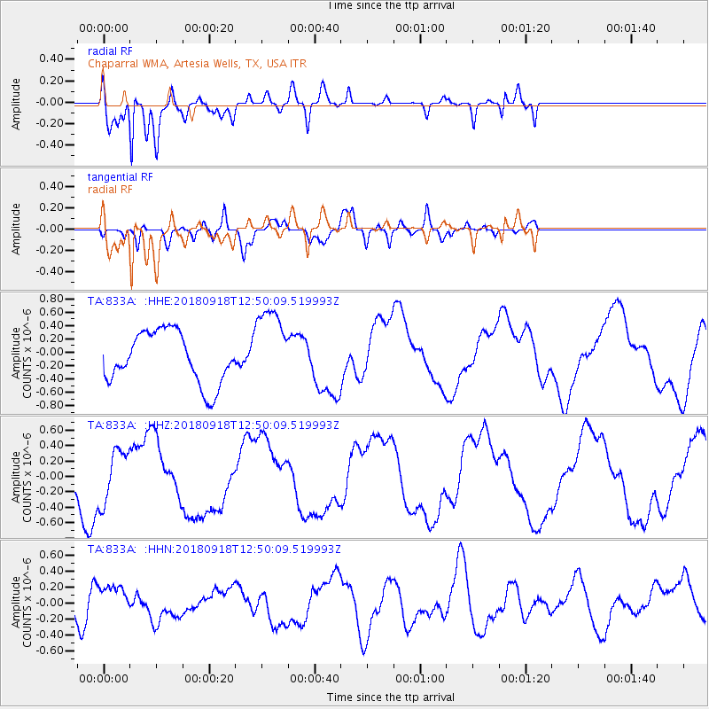
833A Chaparral WMA, Artesia Wells, TX, USA - Earthquake Result Viewer
*The percent match for this event was below the threshold and hence no stack was calculated.
| Earthquake location: |
Fiji Islands Region |
| Earthquake latitude/longitude: |
-20.5/-178.2 |
| Earthquake time(UTC): |
2018/09/18 (261) 12:38:35 GMT |
| Earthquake Depth: |
516 km |
| Earthquake Magnitude: |
5.5 Mww |
| Earthquake Catalog/Contributor: |
NEIC PDE/us |
|
| Network: |
TA USArray Transportable Network (new EarthScope stations) |
| Station: |
833A Chaparral WMA, Artesia Wells, TX, USA |
| Lat/Lon: |
28.32 N/99.39 W |
| Elevation: |
171 m |
|
| Distance: |
90.3 deg |
| Az: |
59.872 deg |
| Baz: |
246.861 deg |
| Ray Param: |
$rayparam |
*The percent match for this event was below the threshold and hence was not used in the summary stack. |
|
| Radial Match: |
92.00707 % |
| Radial Bump: |
400 |
| Transverse Match: |
42.8556 % |
| Transverse Bump: |
400 |
| SOD ConfigId: |
13570011 |
| Insert Time: |
2019-05-01 06:57:05.221 +0000 |
| GWidth: |
2.5 |
| Max Bumps: |
400 |
| Tol: |
0.001 |
|
Signal To Noise
| Channel | StoN | STA | LTA |
| TA:833A: :HHZ:20180918T12:50:09.519993Z | 0.937788 | 3.4571E-7 | 3.686441E-7 |
| TA:833A: :HHN:20180918T12:50:09.519993Z | 1.4079864 | 2.0741172E-7 | 1.4731089E-7 |
| TA:833A: :HHE:20180918T12:50:09.519993Z | 1.572274 | 6.0271566E-7 | 3.8334008E-7 |
| Arrivals |
| Ps | |
| PpPs | |
| PsPs/PpSs | |


