You are here: Home > Network List > TA - USArray Transportable Network (new EarthScope stations) Stations List
> Station J13A Cove Ranch, Picabo, ID, USA > Earthquake Result Viewer
J13A Cove Ranch, Picabo, ID, USA - Earthquake Result Viewer

| Earthquake location: |
Chile-Argentina Border Region |
| Earthquake latitude/longitude: |
-24.2/-67.0 |
| Earthquake time(UTC): |
2007/05/25 (145) 17:47:31 GMT |
| Earthquake Depth: |
180 km |
| Earthquake Magnitude: |
5.5 MB, 5.9 MW, 5.9 MW |
| Earthquake Catalog/Contributor: |
WHDF/NEIC |
|
| Network: |
TA USArray Transportable Network (new EarthScope stations) |
| Station: |
J13A Cove Ranch, Picabo, ID, USA |
| Lat/Lon: |
43.40 N/114.17 W |
| Elevation: |
1552 m |
|
| Distance: |
80.0 deg |
| Az: |
327.141 deg |
| Baz: |
137.188 deg |
| Ray Param: |
0.04812178 |
| Estimated Moho Depth: |
20.25 km |
| Estimated Crust Vp/Vs: |
2.00 |
| Assumed Crust Vp: |
6.291 km/s |
| Estimated Crust Vs: |
3.146 km/s |
| Estimated Crust Poisson's Ratio: |
0.33 |
|
| Radial Match: |
81.13391 % |
| Radial Bump: |
400 |
| Transverse Match: |
69.63246 % |
| Transverse Bump: |
400 |
| SOD ConfigId: |
2564 |
| Insert Time: |
2010-03-06 16:02:25.657 +0000 |
| GWidth: |
2.5 |
| Max Bumps: |
400 |
| Tol: |
0.001 |
|
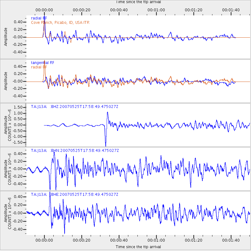
Signal To Noise
| Channel | StoN | STA | LTA |
| TA:J13A: :BHN:20070525T17:58:49.475027Z | 3.8577108 | 1.8084974E-7 | 4.6880068E-8 |
| TA:J13A: :BHE:20070525T17:58:49.475027Z | 4.0206313 | 1.9026768E-7 | 4.7322835E-8 |
| TA:J13A: :BHZ:20070525T17:58:49.475027Z | 10.595338 | 6.271042E-7 | 5.9186803E-8 |
| Arrivals |
| Ps | 3.3 SECOND |
| PpPs | 9.4 SECOND |
| PsPs/PpSs | 13 SECOND |


