You are here: Home > Network List > TA - USArray Transportable Network (new EarthScope stations) Stations List
> Station F21K Alatna River, AK, USA > Earthquake Result Viewer
F21K Alatna River, AK, USA - Earthquake Result Viewer
*The percent match for this event was below the threshold and hence no stack was calculated.
| Earthquake location: |
Solomon Islands |
| Earthquake latitude/longitude: |
-9.0/158.3 |
| Earthquake time(UTC): |
2018/09/20 (263) 05:47:37 GMT |
| Earthquake Depth: |
10 km |
| Earthquake Magnitude: |
5.5 mb |
| Earthquake Catalog/Contributor: |
NEIC PDE/us |
|
| Network: |
TA USArray Transportable Network (new EarthScope stations) |
| Station: |
F21K Alatna River, AK, USA |
| Lat/Lon: |
67.22 N/153.48 W |
| Elevation: |
597 m |
|
| Distance: |
83.5 deg |
| Az: |
16.988 deg |
| Baz: |
227.836 deg |
| Ray Param: |
$rayparam |
*The percent match for this event was below the threshold and hence was not used in the summary stack. |
|
| Radial Match: |
58.569084 % |
| Radial Bump: |
400 |
| Transverse Match: |
58.00152 % |
| Transverse Bump: |
400 |
| SOD ConfigId: |
13570011 |
| Insert Time: |
2019-05-01 07:06:08.608 +0000 |
| GWidth: |
2.5 |
| Max Bumps: |
400 |
| Tol: |
0.001 |
|
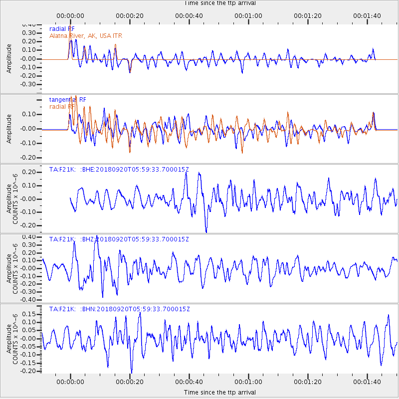
Signal To Noise
| Channel | StoN | STA | LTA |
| TA:F21K: :BHZ:20180920T05:59:33.700015Z | 2.7652755 | 1.8645238E-7 | 6.742633E-8 |
| TA:F21K: :BHN:20180920T05:59:33.700015Z | 1.1184975 | 4.3924526E-8 | 3.927101E-8 |
| TA:F21K: :BHE:20180920T05:59:33.700015Z | 0.61256355 | 3.126121E-8 | 5.1033414E-8 |
| Arrivals |
| Ps | |
| PpPs | |
| PsPs/PpSs | |


