You are here: Home > Network List > TA - USArray Transportable Network (new EarthScope stations) Stations List
> Station H31M Peel River, Yukon, CAN > Earthquake Result Viewer
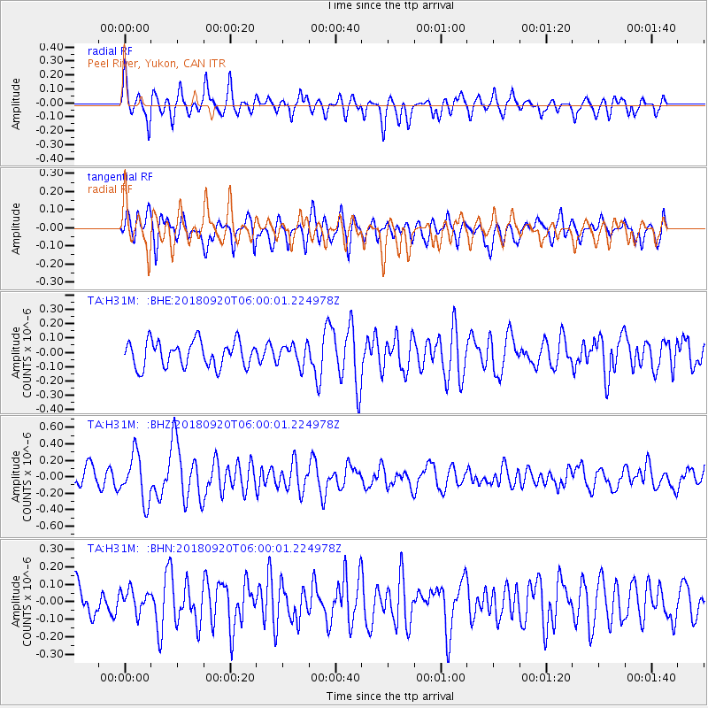
H31M Peel River, Yukon, CAN - Earthquake Result Viewer
*The percent match for this event was below the threshold and hence no stack was calculated.
| Earthquake location: |
Solomon Islands |
| Earthquake latitude/longitude: |
-9.0/158.3 |
| Earthquake time(UTC): |
2018/09/20 (263) 05:47:37 GMT |
| Earthquake Depth: |
10 km |
| Earthquake Magnitude: |
5.5 mb |
| Earthquake Catalog/Contributor: |
NEIC PDE/us |
|
| Network: |
TA USArray Transportable Network (new EarthScope stations) |
| Station: |
H31M Peel River, Yukon, CAN |
| Lat/Lon: |
65.81 N/134.34 W |
| Elevation: |
642 m |
|
| Distance: |
89.1 deg |
| Az: |
22.357 deg |
| Baz: |
245.745 deg |
| Ray Param: |
$rayparam |
*The percent match for this event was below the threshold and hence was not used in the summary stack. |
|
| Radial Match: |
61.70091 % |
| Radial Bump: |
400 |
| Transverse Match: |
64.91255 % |
| Transverse Bump: |
400 |
| SOD ConfigId: |
13570011 |
| Insert Time: |
2019-05-01 07:06:33.101 +0000 |
| GWidth: |
2.5 |
| Max Bumps: |
400 |
| Tol: |
0.001 |
|
Signal To Noise
| Channel | StoN | STA | LTA |
| TA:H31M: :BHZ:20180920T06:00:01.224978Z | 2.9284868 | 2.8745498E-7 | 9.8158196E-8 |
| TA:H31M: :BHN:20180920T06:00:01.224978Z | 0.8196162 | 6.525463E-8 | 7.9616086E-8 |
| TA:H31M: :BHE:20180920T06:00:01.224978Z | 0.7890827 | 7.013818E-8 | 8.888571E-8 |
| Arrivals |
| Ps | |
| PpPs | |
| PsPs/PpSs | |


