You are here: Home > Network List > TA - USArray Transportable Network (new EarthScope stations) Stations List
> Station J20K Nowitna River, AK, USA > Earthquake Result Viewer
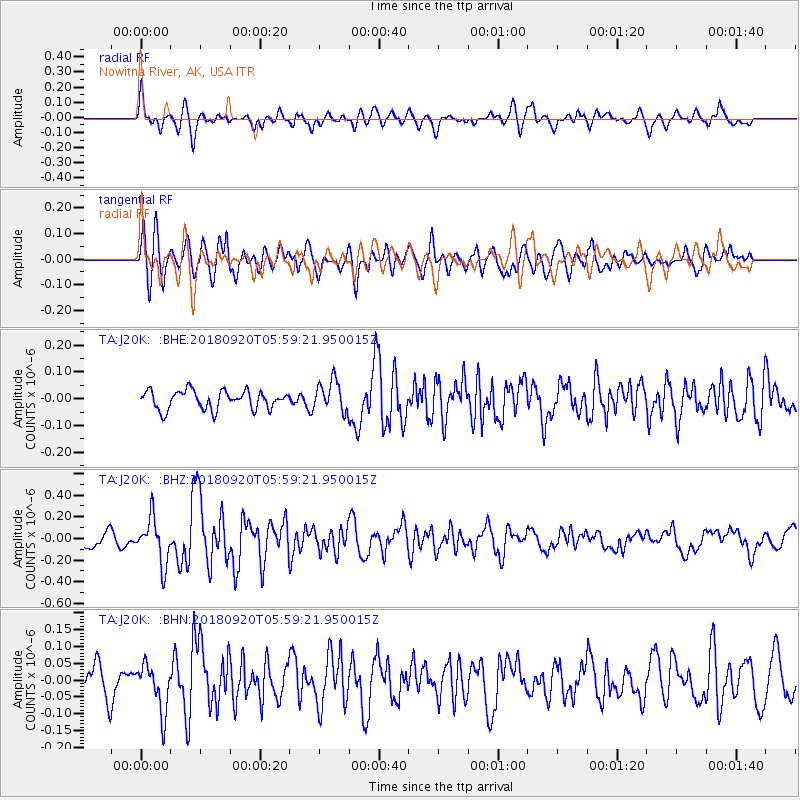
J20K Nowitna River, AK, USA - Earthquake Result Viewer
*The percent match for this event was below the threshold and hence no stack was calculated.
| Earthquake location: |
Solomon Islands |
| Earthquake latitude/longitude: |
-9.0/158.3 |
| Earthquake time(UTC): |
2018/09/20 (263) 05:47:37 GMT |
| Earthquake Depth: |
10 km |
| Earthquake Magnitude: |
5.5 mb |
| Earthquake Catalog/Contributor: |
NEIC PDE/us |
|
| Network: |
TA USArray Transportable Network (new EarthScope stations) |
| Station: |
J20K Nowitna River, AK, USA |
| Lat/Lon: |
64.18 N/154.15 W |
| Elevation: |
314 m |
|
| Distance: |
81.2 deg |
| Az: |
19.083 deg |
| Baz: |
227.51 deg |
| Ray Param: |
$rayparam |
*The percent match for this event was below the threshold and hence was not used in the summary stack. |
|
| Radial Match: |
66.452095 % |
| Radial Bump: |
400 |
| Transverse Match: |
63.073547 % |
| Transverse Bump: |
400 |
| SOD ConfigId: |
13570011 |
| Insert Time: |
2019-05-01 07:06:39.689 +0000 |
| GWidth: |
2.5 |
| Max Bumps: |
400 |
| Tol: |
0.001 |
|
Signal To Noise
| Channel | StoN | STA | LTA |
| TA:J20K: :BHZ:20180920T05:59:21.950015Z | 2.714705 | 2.1033458E-7 | 7.747972E-8 |
| TA:J20K: :BHN:20180920T05:59:21.950015Z | 1.4042817 | 7.091934E-8 | 5.0502216E-8 |
| TA:J20K: :BHE:20180920T05:59:21.950015Z | 1.6585307 | 5.7385158E-8 | 3.4599996E-8 |
| Arrivals |
| Ps | |
| PpPs | |
| PsPs/PpSs | |


